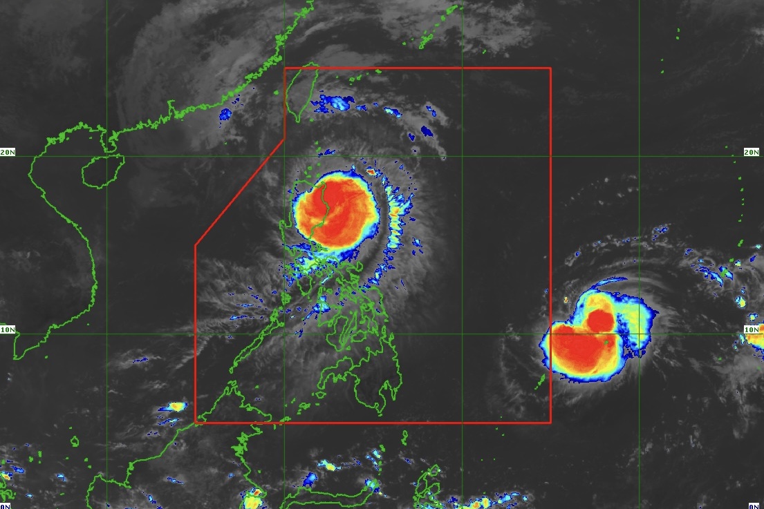
Tropical Storm (TS) "Man-Yi" continues to intensify while moving west southwestward, according to an advisory issued by state weather bureau PAGASA at 11 a.m. on Thursday, November 14, 2024.
As of 10 a.m., the center of TS Man-Yi was estimated based on all available data at 1,375 km east of Northeastern Mindanao, outside of the Philippine Area of Responsibility (PAR) (10.5°N, 138.0°E).
• Intensity
Maximum sustained winds of 85 km/h near the center, gustiness of up to 105 km/h, and central pressure of 996 hPa
• Present Movement
West southwestward at 25 km/h
• Extent of Tropical Cyclone Winds
Strong to gale-force winds extend outwards up to 380 km from the center
GENERAL OUTLOOK FOR THE FORECAST PERIOD
• Due to the high pressure area over the south of Japan, TS Man-Yi is forecast to move southwestward over the next 12 hours before turning generally westward while approaching the eastern boundary of PAR. TS Man-Yi may enter the PAR region evening on Thursday, November 14, 2024 as “Pepito."
• Within the PAR region, the tropical cyclone will move generally west northwestward through the rest of the forecast period. On the track forecast, "Pepito" may make landfall over the eastern coast of Southern Luzon during the weekend (Saturday, November 16, 2024 or Sunday, November 17, 2024). It must be emphasized that the track may still shift within the limit of the forecast confidence cone, especially on the 3rd and 4th day of the forecast track. Therefore, the landfall point may also shift within the range of the forecast confidence cone from the eastern coast of Central Luzon to the eastern coast of Eastern Visayas.
• Man-Yi is forecast to intensify into a severe tropical storm on Thursday, November 14, 2024, and may reach typhoon category by morning of November 15, 2024. The possibility of rapid intensification is not ruled out. Since this tropical cyclone may reach typhoon category while over the Philippine Sea, the possibility for Man-Yi to reach super typhoon category prior to landfall is also not ruled out. Regardless, Man-Yi may make landfall at peak intensity.
• Although it is too early to exactly determine the specific areas to be affected by certain hazards and due to the shifting track forecast of Man-Yi, most areas in Luzon and Eastern Visayas are at risk of heavy rainfall, severe wind, and, possibly, storm surge inundation from Man-Yi which may cause considerable impacts.
• This tropical cyclone may bring potentially risky or hazardous sea conditions (at least moderate to rough or worse) over the eastern seaboard of the country beginning on late Friday, November 15, 2024 or on Saturday, November 16, 2024.
"Considering these developments, the public and disaster risk reduction and management offices concerned are advised to continue monitoring for updates related to this tropical cyclone," the DOST-PAGASA advisory further said.


