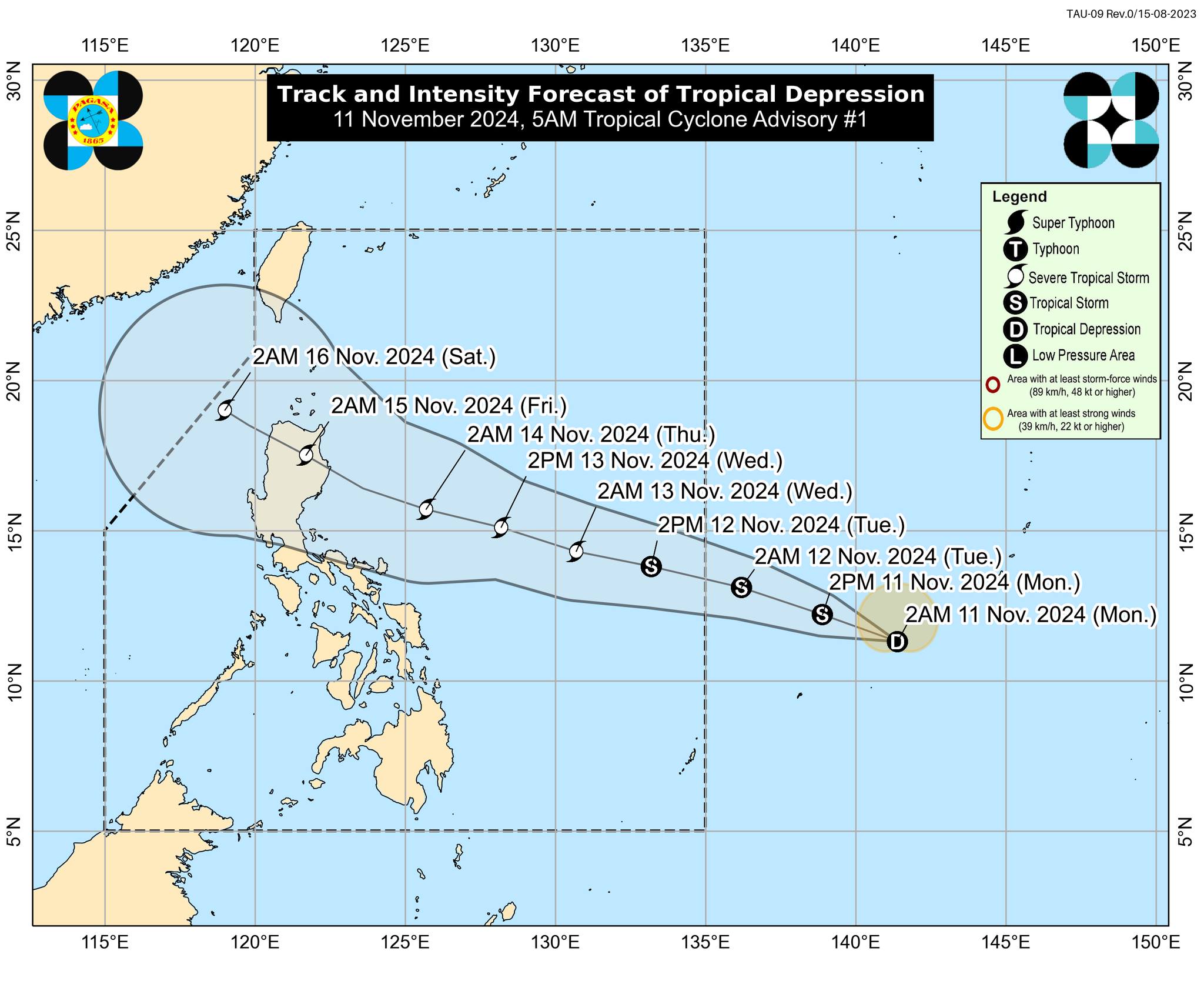
Another Low Pressure Area (LPA) outside the Philippine Area of Responsibility (PAR) developed into a tropical depression based on the 5 a.m. advisory issued by PAGASA on Monday, November 11, 2024.
The center of the tropical depression was estimated based on all available data at 1,620 km East of Eastern Visayas (outside of PAR) (11.4°N, 140.6°E).
•Intensity:
Maximum sustained winds of 45 km/h near the center, gustiness of up to 55 km/h, and central pressure of 1006 hPa
•Present Movement:
West northwestward at 35 km/h
•Extent of Tropical Cyclone Winds:
Strong winds extend outwards up to 190 km from the center
GENERAL OUTLOOK FOR THE FORECAST PERIOD
• The Tropical Depression (TD) will steadily move west northwestward and may enter the Philippine Area of Responsibility (PAR) on November 12, 2024 morning as Tropical Cyclone "Ofel." It will continue to move west northwestward while over Philippine Sea east of Luzon.
• On the forecast track, the TD may make landfall over Northern or Central Luzon on Thursday, November 14, 2024 evening or Friday, November 15, 2024 early morning. Regardless of the position of the landfall point, it must be emphasized that hazards on land and coastal waters may still be experienced in areas outside the landfall point or forecast confidence cone. It must also be emphasized that the track may still shift within the limit of the forecast confidence cone, especially on the 4th and 5th day of the forecast track.
• The TD is forecast to intensify into a severe tropical storm within the next 48 hours and may reach its peak intensity as a severe storm prior to landfall. However, the possibility of reaching typhoon category is not ruled out.
Considering these developments, the public and disaster risk reduction and management offices concerned are advised to continue monitoring for updates related to this tropical cyclone, DOST-PAGASA further said.


