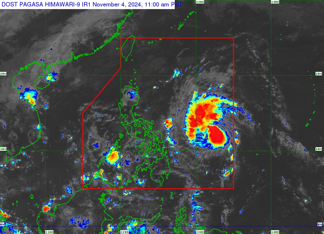
Tropical Storm "Marce" (international name: Yinxing) intensifies slightly as it moves west northwestward over the Philippine Sea based on PAGASA's advisory issued at 11 a.m. on Monday, November 4, 2024.
The center of TS "Marce" was estimated based on all available data at 775 km east of Borongan City, Eastern Samar (12.4°N, 132.5°E).
#MarcePH has a maximum sustained winds of 75 km/h near the center, gustiness of up to 90 km/h, and central pressure of 998 hPa. It is moving west northwestward at 35 km/h.
Strong to gale-force winds extend outwards up to 580 km from the center.
No Tropical Cyclone Wind Signal (TCWS) is hoisted currently.
As #MarcePH moves northwestward within the Philippine Area of Responsility (PAR), it may enhance the northeasterly wind flow which may occur within the week.
"This, and the trough of the tropical cyclone, will bring rains over extreme Northern Luzon and the eastern section of Luzon beginning Monday, November 4, 2024 or on Tuesday, November 5, 2024," state weather bureau PAGASA said.
TCWS No. 1 may be hoisted over portions of Cagayan by November 5, 2024. The highest Wind Signal which may be hoisted during the occurrence of #MarcePH is Wind Signal No. 4.
Furthermore, northeasterly wind flow will also bring strong to gale-force gusts over the following areas (especially in coastal and upland areas exposed to winds):
• November 4, 2024: Batanes, Cagayan including Babuyan Islands, Isabela, Ilocos Norte, Aurora, and the northern portion of Quezon;
• November 5, 2024: Batanes, Cagayan including Babuyan Islands, Isabela, Ilocos Norte, Ilocos Sur, Aurora, Quezon, and Camarines Norte;
• November 6, 2024: Ilocos Region, Quezon, Camarines Norte, Camarines Sur, and Catanduanes.


