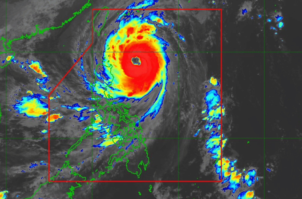
Super Typhoon Leon continues to move closer to Batanes with winds as strong as 185 kph near the center and gustiness of up to 230 kph, PAGASA said night on Wednesday, October 30, 2024.
According to PAGASA's tropical cyclone bulletin issued at 8 p.m., Signal No. 4 remains hoisted over Batanes with PAGASA warning of winds from 118 kph to 184 kph and significant to severe threat to life and property.
PAGASA said Signal No. 5 is not ruled out should Leon move left of its forecast track.
In a 24 Oras report on Wednesday, Batanes Governor Marilou Cayco said it was the first time that about 100 families evacuated in the province as they endured strong winds, rain, and strong waves.
Signal No. 3 is up over the following areas:
- eastern portion of Babuyan Islands (Babuyan Is., Camiguin Is., Calayan Is.,)
- northeastern portion of mainland Cagayan (Santa Ana)
Signal No. 2 is raised over
- The rest of Babuyan Islands
- the rest of mainland Cagayan
- the northern portion of Isabela (Santo Tomas, Santa Maria, Quezon, Delfin Albano, San Pablo, Ilagan City, Tumauini, Cabagan, Palanan, Quirino, Divilacan, Mallig, Maconacon, Gamu, Burgos, Roxas, San Mariano, Reina Mercedes, San Manuel, Naguilian, Benito Soliven)
- Apayao
- Kalinga
- the northern and eastern portions of Abra (Tineg, Lacub, Malibcong, Lagayan, San Juan, Lagangilang, Licuan-Baay, Daguioman)
- the eastern portion of Mountain Province (Paracelis)
- Ilocos Norte
Signal No. 1 is hoisted over:
- The rest of Isabela,
- Quirino,
- Nueva Vizcaya,
- the rest of Mountain Province,
- Ifugao,
- Benguet,
- the rest of Abra,
- Ilocos Sur,
- La Union,
- Pangasinan,
- Nueva Ecija,
- Aurora,
- northeastern portion of Tarlac (Camiling, San Clemente, Paniqui, Moncada, Anao, San Manuel, Pura, Ramos, Victoria, Gerona, Santa Ignacia, City of Tarlac, La Paz)
The typhoon is forecast to move northwestward over the Philippine Sea until it makes landfall along the eastern coast of Taiwan on Thursday afternoon.
Leon is expected to exit the Philippine Area of Responsibility on Thursday evening or early Friday morning.
PAGASA said most of the Cordillera Administrative Region, Quirino, Nueva Vizcaya, Aurora, Bataan, Metro Manila, CALABARZON, MIMAROPA, Bicol Region, Northern Samar, and most of Western Visayas would experience strong to gale-force gusts on Thursday.
State meteorologists warned of moderate to high risk of life-threatening coastal flooding due to storm surge with peak heights exceeding 3.0 m above normal tide levels over the low-lying or exposed coastal localities of Batanes and Babuyan Islands in the next 48 hours.
A gale warning was also hoisted over the seaboard of Northern Luzon and the eastern seaboards of Central and Southern Luzon.
According to the state weather bureau, Leon will be closest to Batanes from late evening today to tomorrow morning.
"A landfall in Batanes is also not ruled out," PAGASA said.
"This super typhoon will be near or at peak intensity during its closest point of approach to Batanes. The landfall of Leon over Taiwan will result in a continuous weakening trend for the rest of the forecast period," it added.
(via MARIEL CELINE SERQUIÑA, GMA Integrated News)


