

Several areas in Luzon were placed under Tropical Cyclone Wind Signal (TCWS) No. 1 because of the effects of #LeonPH.
These include the eastern portion of mainland Cagayan (Santa Ana, Lal-Lo, Gattaran, Baggao, Santa Teresita, Gonzaga, Peñablanca), the eastern portion of Isabela (Maconacon, Divilacan, Ilagan City, San Pablo, Cabagan, Tumauini, Palanan, San Mariano, Dinapigue), and the northeastern portion of Catanduanes (Pandan, Bagamanoc, Panganiban, Viga).
These areas may experience strong winds.
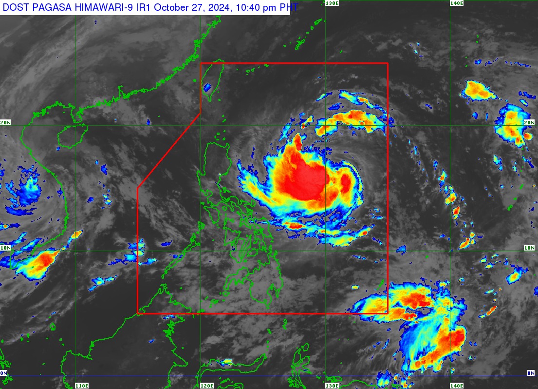
In its 11 p.m. bulletin on Sunday, October 27, 2024, state weather bureau PAGASA said #LeonPH has intensified slightly as it continued to move westward over the Philippine Sea.
As of 10 p.m. Sunday, the center of #LeonPH was estimated at 915 km East of Central Luzon (16.5°N, 130.7°E).
#LeonPH has maximum sustained winds of 85 km/h near the center, gustiness of up to 105 km/h, and central pressure of 990 hPa.
PAGASA said strong to gale-force winds extend outwards up to 520 km from the center.
TRACK AND INTENSITY OUTLOOK
PAGASA said #LeonPH is forecast to move westward for the next 24 hours before moving generally northwestward evening on Monday, October 28, 2024, until Wednesday, October 30, then north northwestward for the rest of the forecast period.
On the track forecast, #LeonPH remains far from the Philippine landmass and may pass very close or make landfall over northern Taiwan, PAGASA said.
It said further that "further westward shift in the track forecast may still occur but within the limit of the forecast confidence cone, especially on the day-4 and day-5 of the forecast track. Such westward shift may bring the Wednesday-Thursday segment of the track forecast closer to Extreme Northern Luzon."
#LeonPH is expected to intensify gradually in the next 24 hours and may reach severe tropical storm category Monday and typhoon category on Tuesday. This tropical cyclone may also undergo rapid intensification, PAGASA said.
