

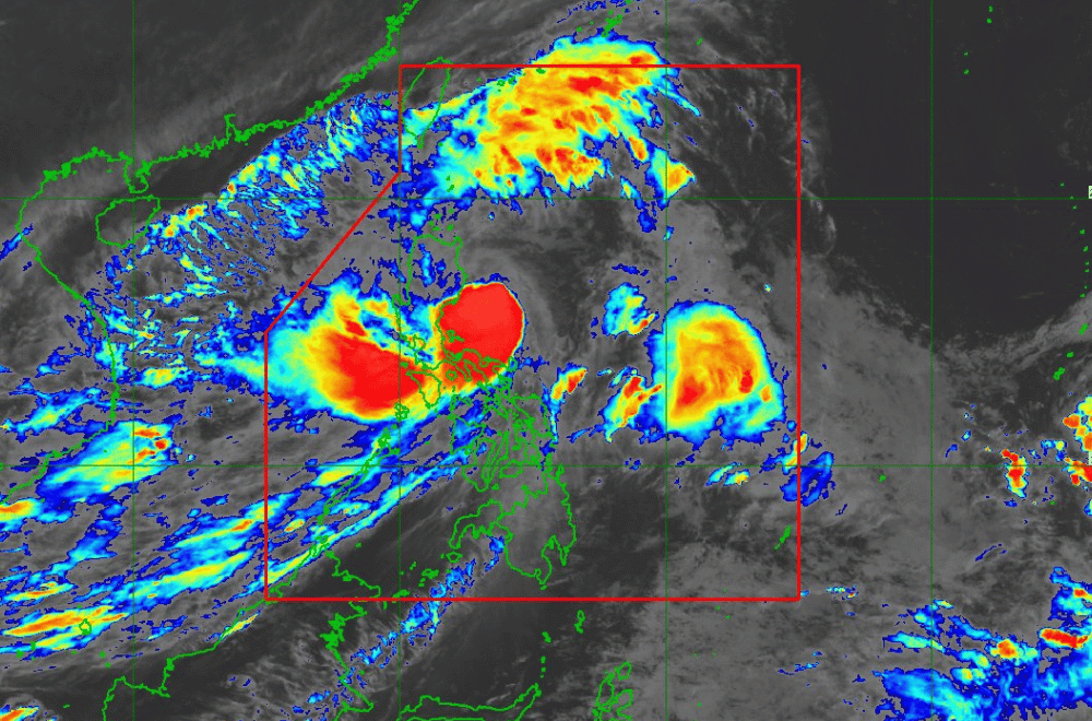
#KristinePH has intensified into a severe tropical storm while moving northwestward, according to the Philippine Atmospheric, Geophysical and Astronomical Services Administration (PAGASA).
As of 4:00 p.m. on October 23, 2024, the center of #KristinePH was located 175 km east of Echague, Isabela, with coordinates 16.5°N, 123.3°E.
The storm is moving at a speed of 20 km/h in a northwestward direction.
Currently, #KristinePH has maximum sustained winds of 95 km/h near its center, with gustiness reaching up to 115 km/h and a central pressure of 980 hPa.
Tropical Cyclone Wind Signal No. 3 has been raised over:
- Isabela
- Kalinga
- Mountain Province
- Ifugao
- Central portion of Abra (Malibcong, Licuan-Baay, Sallapadan, Daguioman, Bucloc, Boliney, Tubo, Luba, Manabo, Bucay, Villaviciosa, Pilar, San Isidro, Pe)
- Benguet
- Quirino
- Nueva Vizcaya
- Northern and central portions of Aurora (Dilasag, Casiguran, Dinalungan, Dipaculao, Maria Aurora, Baler)
- Northern portion of Nueva Ecija (Carranglan, Lupao, San Jose City, Pantabangan)
- Pangasinan
- La Union
- Central and southern portions of Ilocos Sur (Cervantes, Quirino, Sigay, Suyo, Alilem, Sugpon, Tagudin, Santa Cruz, Salcedo, Gregorio del Pilar, San Emilio, Lidlidda, Burgos, San Esteban, Santiago, Banayoyo, Galimuyod, City of Candon, Santa Lucia, Nagbukel, Santa Maria, Narvacan)
Tropical Cyclone Wind Signal No. 2 has been raised over:
- Ilocos Norte
- Rest of Ilocos Sur
- Apayao
- Rest of Abra
- Cagayan including Babuyan Islands
- Rest of Aurora
- Rest of Nueva Ecija
- Bulacan
- Tarlac
- Pampanga
- Zambales
- Bataan
- Metro Manila
- Cavite
- Laguna
- Rizal
- Quezon including Polillo Islands
- Camarines Norte
- Camarines Sur
- Catanduanes
Tropical Cyclone Wind Signal No. 1 has been raised over:
Luzon:
- Batanes
- Batangas
- Occidental Mindoro including Lubang Islands
- Oriental Mindoro
- Marinduque
- Romblon
- Calamian Islands
- Albay
- Sorsogon
- Masbate including Ticao and Burias Islands
Visayas:
- Aklan
- Capiz
- Antique including Caluya Islands
- Iloilo
- Guimaras
- Northern portion of Negros Occidental (Pontevedra, La Castellana, Moises Padilla, Bago City, La Carlota City, Valladolid, Pulupandan, Bacolod City, San Enrique, Murcia, Silay City, City of Talisay, Enrique B. Magalona, Manapla, City of Victorias, Cadiz City, Sagay City, City of Escalante, Toboso, Calatrava, Salvador Benedicto, San Carlos City)
- Northern portion of Negros Oriental (Vallehermoso, Canlaon City, City of Guihulngan)
- Northern and central portions of Cebu (Alcantara, Argao, Dumanjug, Sibonga, Pinamungahan, Ronda, Liloan, Cebu City, Moalboal, Consolacion, Danao City, Borbon, Carmen, Daanbantayan, Tuburan, City of Bogo, Tabogon, City of Naga, Lapu-Lapu City, City of Carcar, Mandaue City, Catmon, Minglanilla, Toledo City, Cordova, Compostela, San Remigio, Balamban, Aloguinsan, San Fernando, Asturias, Barili, Medellin, Sogod, Tabuelan, City of Talisay) including Bantayan Islands and Camotes Islands
- Bohol
- Eastern Samar
- Northern Samar
- Samar
- Leyte
- Biliran
- Southern Leyte
Mindanao:
- Dinagat Islands and Surigao del Norte including Siargao - Bucas Grande Group
Severe Winds:
The wind signals warn the public of the general wind threat over the affected areas due to the tropical cyclone. Local winds may be slightly stronger/enhanced in coastal and upland/mountainous areas exposed to winds.
- Moderate to significant impacts from storm-force winds are possible within any of the localities where Wind Signal No. 3 is hoisted.
- Minor to moderate impacts from gale-force winds are possible within any of the localities where Wind Signal No. 2 is hoisted.
- Minimal to minor impacts from strong winds are possible within any of the areas under Wind Signal No. 1.
Furthermore, the wind flow coming towards the circulation of #KristinePH and the Northeasterly Windflow will also bring strong to gale-force gusts over the following areas, especially in coastal and upland areas exposed to winds:
- Today (23 October): MIMAROPA, Visayas, and Mindanao.
- Tomorrow (24 October): MIMAROPA, Bicol Region, Visayas, Basilan, Sulu, Tawi-Tawi, Zamboanga del Norte, Lanao del Sur, Northern Mindanao, Dinagat Islands, Surigao del Norte, Davao del Sur, and Davao Oriental.
- Friday (25 October): MIMAROPA, Bicol Region, Western Visayas, Negros Occidental, Zamboanga del Norte, Basilan, Sulu, and Tawi-Tawi.
Coastal Inundation:
There is a moderate to significant risk of life-threatening storm surge in the next 48 hours over the low-lying or exposed coastal localities of Ilocos Norte, Ilocos Sur, La Union, Pangasinan, Cagayan, Isabela, Zambales, Aurora, and Quezon. For more information, refer to Storm Surge Warning No. 6 issued at 2:00 PM today.
