

Tropical Depression #KristinePH has maintained its strength while moving west-southwestward over the Philippine Sea, according to the Philippine Atmospheric, Geophysical and Astronomical Services Administration (PAGASA).
As of 5:00 p.m. on October 21, 2024, the center of #KristinePH was located 760 km east of Catarman, Northern Samar (13.2 °N, 131.6 °E).
The storm is moving at a speed of 15 km/h in a westward direction.
The storm currently has maximum sustained winds of 55 km/h near its center, with gustiness reaching up to 70 km/h.
Tropical Cyclone Wind Signal No. 1 has been raised over:
Luzon:
- The southeastern portion of Isabela (Palanan, Dinapigue)
- Aurora
- The northern and eastern portions of Quezon (Tagkawayan, Guinayangan, Buenavista, San Narciso, San Andres, General Nakar, Pitogo, San Francisco, Calauag, Pagbilao, Infanta, Lopez, Catanauan, Mulanay, Unisan, General Luna, Plaridel, Quezon, Alabat, Sampaloc, Padre Burgos, Macalelon, Mauban, Perez, Agdangan, Gumaca, Atimonan, Real), including Polillo Islands
- Camarines Norte
- Camarines Sur
- Catanduanes
- Albay
- Sorsogon
- Masbate, including Ticao and Burias Islands
Visayas:
- Eastern Samar
- Northern Samar
- Samar
- Leyte
- Biliran
- Southern Leyte
Mindanao:
- Dinagat Islands
- Surigao del Norte, including Siargao - Bucas Grande Group
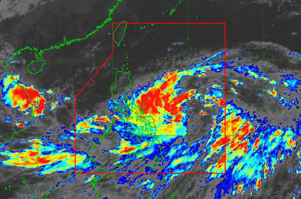
Heavy Rainfall Outlook:
Refer to Weather Advisory No. 4 issued at 5:00 PM today for the heavy rainfall outlook due to #Kristine.
Severe Winds:
The wind signals warn the public of the general wind threat over an area due to the tropical cyclone. Local winds may be slightly stronger in coastal and upland/mountainous areas exposed to winds. Minimal to minor impacts from strong winds are possible within any of the areas under Wind Signal No. 1.
The highest wind signal which may be hoisted during the occurrence of #Kristine is Wind Signal No. 4. Furthermore, strong to gale-force gusts will affect various regions:
- Today (21 October): Batanes, Ilocos Norte, Cagayan, southern Palawan, Siquijor, Bohol, Zamboanga Peninsula, Northern Mindanao, Dinagat Islands, Surigao del Norte, Agusan del Norte, BARMM, Sarangani, Davao del Sur, and Davao Oriental.
- Tomorrow (22 October): Batanes, Babuyan Islands, Ilocos Norte, Ilocos Sur, Palawan, Romblon, Aklan, Antique, Negros Island Region, northern Cebu, Bohol, Southern Leyte, Zamboanga del Norte, Northern Mindanao, Dinagat Islands, Surigao del Norte, Agusan del Norte, Sarangani, Davao del Sur, and Davao Oriental.
- Wednesday (23 October): MIMAROPA, Visayas, and Mindanao.
Hazards Affecting Coastal Waters:
A Gale Warning is hoisted over the eastern seaboards of Southern Luzon and Visayas. For more information, refer to Gale Warning No. 1 issued at 5:00 PM today.
24-Hour Sea Condition Outlook:
- Up to very rough seas over the following coastal waters:
- Up to 5.5 m: The northern and eastern seaboards of the Bicol Region.
- Up to 5.0 m: The northern and eastern seaboards of Northern Samar.
- Up to 4.5 m: The seaboards of Isabela, Aurora, Polillo Islands, and the eastern seaboards of mainland Cagayan.
Sea travel is risky for all types of vessels. Mariners are advised to remain in port or seek shelter until winds and waves subside.
- Up to rough seas over the following coastal waters:
- Up to 4.0 m: The seaboard of Batanes, remaining seaboards of Cagayan, including Babuyan Islands, and the eastern seaboard of Eastern Samar.
- Up to 3.5 m: The remaining seaboards of Northern Luzon, the seaboard of Dinagat Islands, and Surigao del Norte.
- Up to 3.0 m: The seaboards of Bohol, Siquijor, Camiguin, the eastern seaboard of Davao Region, and the eastern seaboard of mainland Quezon.
Mariners of small crafts, including motorbancas, are advised not to venture out to sea under these conditions.
- Up to moderate seas over the following coastal waters:
- Up to 2.5 m: The remaining seaboards of the country.
Mariners of motorbancas and similarly-sized vessels are advised to take precautionary measures while navigating.
Track and Intensity Outlook:
#KristinePH is forecast to move west-southwestward until tomorrow morning before turning generally west-northwestward for the rest of the forecast period. This tropical cyclone may make landfall over Northern Luzon on Thursday evening or Friday morning. Changes in the forecast track are not ruled out, depending on the movement of surrounding weather systems.
#KristinePH may intensify into a tropical storm in the next 12 hours. It may reach severe tropical storm category on Wednesday and typhoon category on Thursday before making landfall. Rapid intensification is not ruled out given the favorable environmental conditions.
