

Tropical Depression #KristinePH is moving west-southwestward over the Philippine Sea, prompting the Philippine Atmospheric, Geophysical and Astronomical Services Administration (PAGASA) to raise Tropical Cyclone Wind Signal No. 1 in Luzon and Visayas.
As of 5:00 a.m. on October 21, 2024, the center of #KristinePH was located 1,050 km east of Southeastern Luzon.
The storm is moving west-southwestward at a speed of 30 km/h.
It currently has maximum sustained winds of 55 km/h near its center, with gustiness reaching up to 70 km/h.
Tropical Cyclone Wind Signal No. 1 has been raised over:
Luzon:
- Catanduanes
Visayas:
- The northeastern portion of Northern Samar (Laoang, Palapag, Mapanas, Gamay, Catubig, Lapinig)
- The northeastern portion of Eastern Samar (Jipapad, Arteche, San Policarpo, Oras)
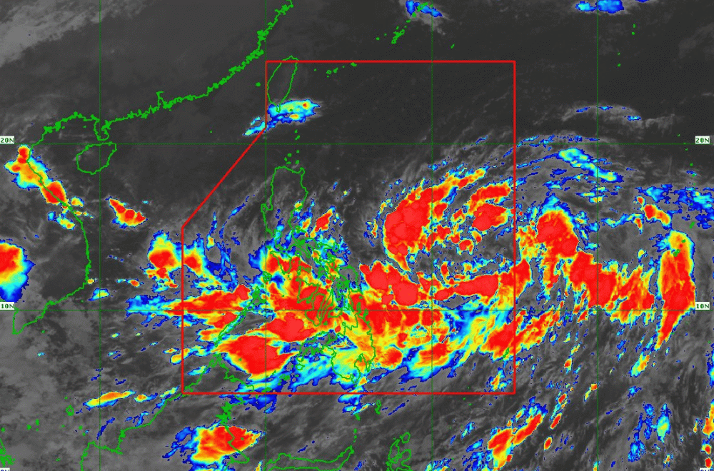
Heavy Rainfall Outlook:
For the heavy rainfall outlook due to #KristinePH, refer to Weather Advisory No. 2 issued at 5:00 AM today.
Severe Winds:
Residents in areas under Signal No. 1 should expect minimal to minor impacts from strong winds, particularly in coastal and upland areas exposed to gusts. The highest possible Wind Signal for #KristinePH is No. 4. Gale-force gusts may also affect parts of Palawan, Visayas, and Mindanao, including the southern portion of Palawan, Siquijor, Bohol, and Zamboanga Peninsula today.
Hazards Affecting Coastal Waters:
Moderate to rough seas are expected in the following coastal waters:
- Up to 4.0 m: Seaboards of Isabela, northern Aurora, Catanduanes, Northern Samar, and eastern Cagayan.
- Up to 3.5 m: Seaboard of Batanes, remaining seaboards of Cagayan and Aurora, eastern Quezon, and the Bicol Region. Mariners of small sea vessels are advised not to venture out due to risky sea conditions.
Track and Intensity Outlook:
#KristinePH is expected to continue moving westward until tomorrow morning, before turning west-northwestward. It may make landfall over northeastern Cagayan by Friday afternoon. The storm is expected to intensify into a tropical storm within 12 hours, potentially becoming a severe tropical storm by tomorrow and reaching typhoon status by Thursday before landfall. Further strengthening is possible due to favorable environmental conditions.
PAGASA advises the public to stay updated on further advisories and to take necessary precautions as #KristinePH progresses.
