

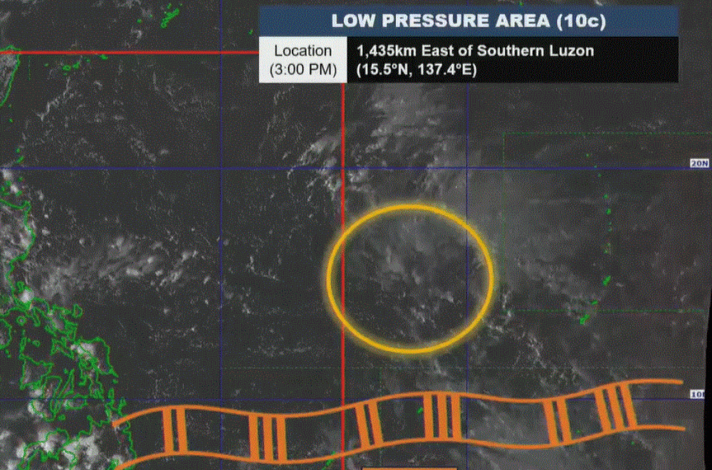
State weather bureau PAGASA said it is monitoring a low pressure area (LPA) that has a "medium chance" of becoming a tropical cyclone in 24 to 48 hours.
In its 4 p.m. forecast, weather specialist Ana Clauren-Jorda said the LPA spotted 1,435 kilometers east of Southern Luzon may enter the Philippine Area of Responsibility Sunday or Monday, according to a report in GMA News Online.
The Intertropical Convergence Zone (ITCZ) will continue to bring cloudy skies and rains in parts of Mindanao.
Cloudy skies with scattered rains and thunderstorms will be experienced over Zamboanga Peninsula, SOCCSKSARGEN, BARMM, Davao Occidental, and Davao del Sur. Partly cloudy to cloudy skies with isolated rain showers or thunderstorms will be felt over Visayas, Palawan, and the rest of Mindanao.
Partly cloudy to cloudy skies with isolated rain showers or thunderstorms are also expected over Cagayan Valley, Aurora, Quezon, and Bicol Region due to the easterlies, while partly cloudy to cloudy skies with isolated rain showers or thunderstorms may be felt over the rest of the country caused by localized thunderstorms.
Possible flash floods or landslides may occur over some parts of the country due to the said weather conditions.
Meanwhile, light to moderate winds with slight to moderate coastal waters may be felt over the whole archipelago.
Sunrise in Metro Manila will be at 5:48 a.m. on Saturday.
