

Typhoon #JulianPH has continued to strengthen as it moves closer to Batanes, according to the latest update from the Philippine Atmospheric, Geophysical and Astronomical Services Administration (PAGASA).
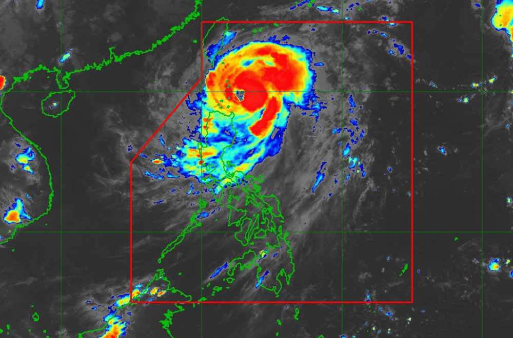
As of 8:00 p.m. on September 29, 2024, the center of #JulianPH was located 150 km east southeast of Basco, Batanes.
The typhoon is moving northwestward at a speed of 15 km/h.
It currently has maximum sustained winds of 140 km/h near its center, with gustiness reaching up to 170 km/h.
Tropical Cyclone Wind Signal No. 4 has been raised over:
- Batanes
Tropical Cyclone Wind Signal No. 3 has been raised over:
- Babuyan Islands
Tropical Cyclone Wind Signal No. 2 has been raised over:
- Mainland Cagayan,
- Apayao; and,
- Ilocos Norte
Tropical Cyclone Wind Signal No. 1 has been raised over:
- Ilocos Sur,
- La Union,
- Abra,
- Kalinga,
- Ifugao,
- Mountain Province,
- Benguet,
- Isabela,
- Nueva Vizcaya,
- Quirino, and;
- The northern and central portions of Aurora (Dilasag, Casiguran, Dinalungan, Dipaculao, Maria Aurora, Baler)
Heavy Rainfall Outlook:
PAGASA advises referring to Weather Advisory No. 12 issued at 5:00 p.m. today for the heavy rainfall outlook due to Typhoon Julian.
Severe Winds:
Areas under Wind Signal No. 4 may experience significant to severe impacts from typhoon-force winds, particularly in coastal and upland regions.
For localities under Wind Signal No. 3, moderate to significant impacts from storm-force winds are expected, while areas under Wind Signal No. 2 could experience minor to moderate impacts from gale-force winds.
Areas under Wind Signal No. 1 may see minimal to minor impacts from strong winds. In addition, gale-force gusts may affect Pangasinan, Zambales, Bataan, Metro Manila, CALABARZON, Romblon, and Bicol Region today and tomorrow, extending to other areas by Tuesday (October 1).
Coastal Inundation:
There is a moderate to high risk of life-threatening storm surge over the next 48 hours in Batanes, Babuyan Islands, and northern mainland Cagayan. Storm Surge Warning No. 2 was issued at 8:00 p.m. for more information.
Hazards Affecting Coastal Waters:
A Gale Warning is in effect for the northern and eastern seaboards of Northern Luzon. Seas around Batanes are forecast to reach heights above 14.0 meters, while the seaboards of Babuyan Islands could experience up to 8.0 meters of seas. Sea travel is deemed risky for all types and tonnage of vessels.
Track and Intensity Outlook:
#JulianPH is expected to move west northwestward over the Balintang and Bashi Channels through Tuesday morning, possibly making landfall or passing close to Batanes tomorrow. By Tuesday afternoon, the typhoon will sharply turn northward towards Taiwan and is forecast to make landfall on Tuesday evening or Wednesday morning. The typhoon will then accelerate north northeastward, exiting the Philippine Area of Responsibility by Thursday (October 3).
#JulianPH is forecast to continue intensifying and may reach super typhoon status within the next 48 hours, potentially during its pass near or over Batanes.
