

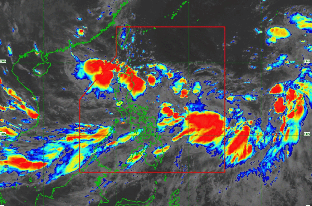
Tropical Depression #GenerPH has slightly accelerated and is now moving towards Northern Luzon, with landfall expected tonight or early tomorrow morning, according to the latest advisory from the Philippine Atmospheric, Geophysical, and Astronomical Services Administration (PAGASA).
As of 8:00 p.m. on September 16, 2024, the center of #GenerPH was located approximately 240 km east of Tuguegarao City, Cagayan. The storm is moving west-northwestward at 15 km/h, with maximum sustained winds of 55 km/h near the center and gustiness of up to 70 km/h.
Tropical Cyclone Wind Signal No. 1 remains in effect for the following areas:
- Cagayan, including Babuyan Islands
- Isabela
- Quirino
- Nueva Vizcaya
- Apayao
- Kalinga
- Abra
- Ifugao
- Mountain Province
- Benguet
- Ilocos Norte
- Ilocos Sur
- La Union
- Pangasinan
- Zambales
- Tarlac
- Nueva Ecija
- Aurora
- Northern portion of Quezon (General Nakar, Infanta, Real), including Polillo Islands
Heavy Rainfall Outlook:
Refer to Weather Advisory No. 22 for detailed rainfall forecasts due to both #GenerPH and the Southwest Monsoon. Areas affected by these weather systems are expected to experience significant rainfall, potentially leading to flooding.
Severe Winds:
Residents in areas under Wind Signal No. 1 should be prepared for minimal to minor impacts from strong winds. Coastal and upland regions are particularly vulnerable to stronger gusts. The Southwest Monsoon, enhanced by #GenerPH and Tropical Storm Pulasan, will also bring strong to gale-force gusts across several regions:
- On September 16: Batanes, MIMAROPA, Bicol Region, Visayas, Zamboanga Peninsula, Northern Mindanao, Caraga Region, and Davao Region.
- On September 17: Batanes, MIMAROPA, Bicol Region, Visayas, and Mindanao.
- On September 18: Zambales, Bataan, Pampanga, Bulacan, Metro Manila, CALABARZON, MIMAROPA, Bicol Region, Visayas, and Mindanao.
Hazards Affecting Coastal Waters:
A Gale Warning remains in effect for several coastal areas, including the western and southern seaboards of Southern Luzon, Visayas, and Mindanao. Mariners are advised to avoid sea travel due to risky conditions with waves reaching up to 3.5 meters in some areas.
Track and Intensity Outlook:
#GenerPH is forecast to make landfall in Isabela or Aurora tonight or early tomorrow morning and may emerge over La Union or Pangasinan by late tomorrow morning or afternoon. The storm will then move westward over the West Philippine Sea and turn northwestward on Thursday as it approaches southern mainland China.
While #GenerPH is expected to remain a tropical depression as it crosses Luzon, there is a possibility it could strengthen into a tropical storm over the West Philippine Sea by tomorrow evening or Wednesday morning.
PAGASA advises the public to stay updated and take necessary precautions as #GenerPH approaches Northern Luzon.
