

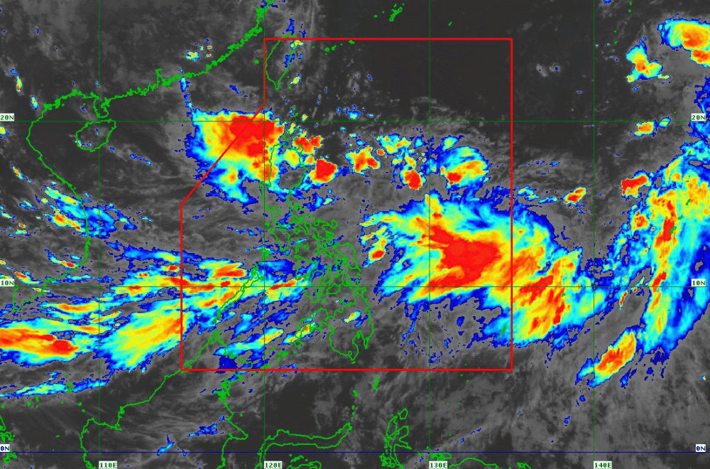
Tropical Depression #GenerPH is moving closer to Northern Luzon, with landfall expected tonight or early tomorrow morning, according to the latest advisory from the Philippine Atmospheric, Geophysical, and Astronomical Services Administration (PAGASA).
As of 5:00 p.m. on September 16, 2024, the center of #GenerPH was located approximately 290 km east of Tuguegarao City, Cagayan.
The storm is moving northwestward at 10 km/h, with maximum sustained winds of 55 km/h near the center and gustiness of up to 70 km/h.
Tropical Cyclone Wind Signal No. 1 remains hoisted over the following areas:
- Cagayan, including Babuyan Islands
- Isabela
- Quirino
- Nueva Vizcaya
- Apayao
- Kalinga
- Abra
- Ifugao
- Mountain Province
- Benguet
- Ilocos Norte
- Ilocos Sur
- La Union
- Pangasinan
- Zambales
- Tarlac
- Nueva Ecija
- Aurora
- Northern portion of Quezon (General Nakar, Infanta, Real), including Polillo Islands
Heavy Rainfall Outlook:
PAGASA warns of heavy rainfall in areas affected by both #GenerPH and the Southwest Monsoon, with Weather Advisory No. 21 highlighting regions at risk. Batanes, MIMAROPA, Bicol Region, Visayas, and Mindanao are particularly advised to prepare for intense rainfall and possible flooding.
Severe Winds:
Areas under Tropical Cyclone Wind Signal No. 1 should anticipate minimal to minor impacts from strong winds. Coastal and upland areas exposed to winds are more vulnerable to stronger gusts, especially with the Southwest Monsoon enhanced by #GenerPH and Tropical Storm Pulasan.
Hazards Affecting Coastal Waters:
A Gale Warning remains in effect for several coastal areas, including the western and southern seaboards of Southern Luzon, the seaboards of Visayas, and the western, northern, and eastern seaboards of Mindanao. Mariners of small seacrafts are strongly advised to avoid sea travel, as sea conditions remain risky with waves reaching 1.5 to 3.5 meters in height.
Track and Intensity Outlook:
Tropical Depression #GenerPH is expected to make landfall in the Isabela or Aurora region tonight or early tomorrow morning. After crossing Luzon, it is forecasted to move westward over the West Philippine Sea. #GenerPH may exit the Philippine Area of Responsibility (PAR) between late tomorrow evening and Wednesday morning.
While #GenerPH is likely to remain a tropical depression as it traverses Luzon, there is a possibility it could strengthen into a tropical storm as it heads towards southern mainland China by Thursday.
PAGASA urges the public to stay informed and follow updates as #GenerPH approaches Northern Luzon.
