

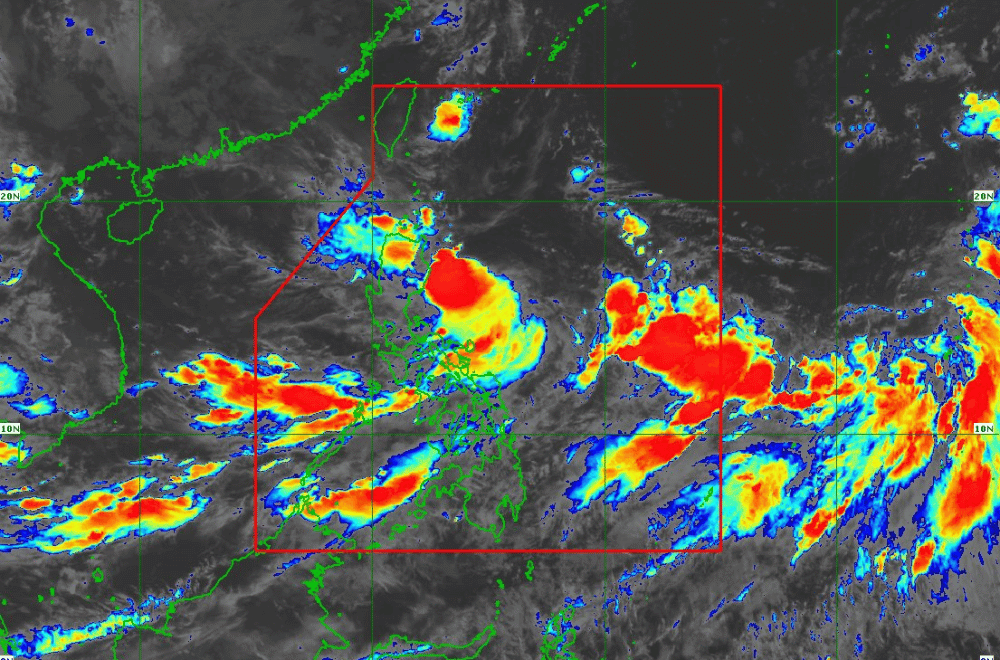
Tropical Depression #GenerPH has slightly intensified while moving slowly west-southwestward, according to the Philippine Atmospheric, Geophysical and Astronomical Services Administration (PAGASA).
As of 11:00 a.m. on September 16, 2024, the center of #GenerPH was located 325 km east-northeast of Casiguran, Aurora.
The storm is moving slowly in a west-southwestward direction.
The storm currently has maximum sustained winds of 55 km/h near its center, with gustiness reaching up to 70 km/h.
Tropical Cyclone Wind Signal No. 1 has been raised over:
- Cagayan, including Babuyan Islands
- Isabela
- Quirino
- Nueva Vizcaya
- Apayao
- Kalinga
- Abra
- Ifugao
- Mountain Province
- Benguet
- Ilocos Norte
- Ilocos Sur
- La Union
- Pangasinan
- Zambales
- Tarlac
- Nueva Ecija
- Aurora
- The northern portion of Quezon (General Nakar, Infanta, Real), including Polillo Islands
Heavy Rainfall Outlook:
PAGASA has issued a Weather Advisory, warning of heavy rainfall from both #GenerPH and the enhanced Southwest Monsoon.
Regions such as MIMAROPA, Bicol Region, Visayas, Zamboanga Peninsula, Northern Mindanao, Caraga, and Davao Region may experience strong to gale-force gusts, especially in coastal and upland areas.
Severe Winds:
Areas under Tropical Cyclone Wind Signal No. 1 may experience minimal to minor impacts from strong winds, with potentially stronger gusts in coastal and elevated regions.
The Southwest Monsoon, enhanced by #GenerPH and Tropical Cyclone “Pulasan,” is expected to bring strong winds across regions mentioned above, with particular caution for the next three days.
Hazards Affecting Coastal Waters:
Gale Warnings have been issued for the western and southern seaboards of Southern Luzon, the seaboards of Visayas, and the western, northern, and eastern seaboards of Mindanao. Mariners of small seacrafts are advised to avoid sea travel in these areas, as sea conditions range from moderate to rough, with wave heights between 1.5 to 3.5 meters.
Track and Intensity Outlook:
Tropical Depression #GenerPH is forecast to make landfall in the vicinity of Isabela or Aurora within the next 24 hours. It may move across the coastal waters of La Union or Pangasinan by tomorrow morning, then continue west-southwestward over the West Philippine Sea.
#GenerPH may exit the Philippine Area of Responsibility (PAR) between tomorrow evening and Wednesday morning. While it is expected to remain a tropical depression as it crosses Luzon, the possibility of intensifying into a tropical storm before landfall is not ruled out.
PAGASA advises the public to stay updated on further advisories and to take necessary precautions as #GenerPH progresses.
