

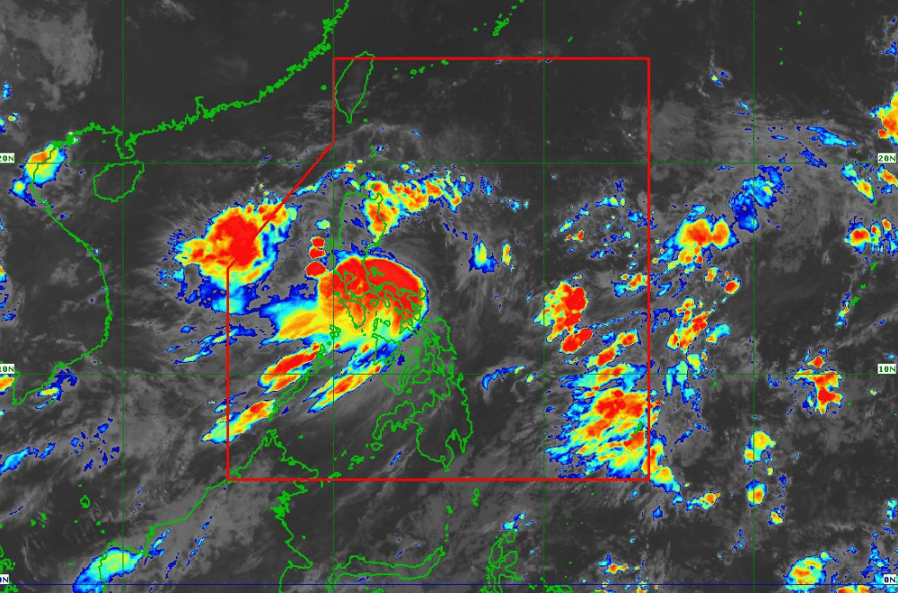
Tropical Storm #EntengPH has intensified and continues to move northwestward near Daet, Camarines Norte, according to the Philippine Atmospheric, Geophysical and Astronomical Services Administration (PAGASA).
As of 8:00 a.m. of September 2, 2024, the center of #EntengPH was located approximately 100 kilometers north-northwest of Daet, Camarines Norte, or 115 kilometers east-northeast of Infanta, Quezon.
It has sustained winds of 75 km/h near its center, with gustiness reaching up to 90 km/h.
Tropical Cyclone Wind Signal No. 2 has been raised over:
- Camarines Norte: Vinzons, San Lorenzo Ruiz, Talisay, Daet, Labo, Paracale, Jose Panganiban, San Vicente, Basud, Mercedes, Santa Elena, Capalonga
- Camarines Sur: Garchitorena, Caramoan, Presentacion, San Jose, Lagonoy, Tinambac, Siruma, Goa
- Cagayan: Peñablanca, Gonzaga, Santa Teresita, Buguey, Lal-Lo, Gattaran, Baggao, Santa Ana, Lasam, Santo Niño, Alcala, Amulung, Solana, Iguig, Tuguegarao City, Enrile, Aparri, Ballesteros, Camalaniugan, Allacapan, Piat, Tuao, Rizal, Abulug, Pamplona
- Babuyan Islands
- Isabela: Santa Maria, Santo Tomas, Cabagan, Delfin Albano, Quirino, Gamu, Burgos, Luna, Reina Mercedes, City of Cauayan, Alicia, Echague, Jones, San Agustin, Angadanan, San Guillermo, San Pablo, Maconacon, Tumauini, Ilagan City, Palanan, Divilacan, San Mariano, Naguilian, Benito Soliven, Dinapigue, Cabatuan, Aurora, San Manuel, Mallig, Quezon, Roxas
- Aurora: Casiguran, Dilasag, Dinalungan
- Polillo Islands
- Quirino: Maddela (eastern portion)
- Apayao: Luna, Santa Marcela, Flora, Pudtol, Calanasan (northern portion)
- Kalinga: Rizal (eastern portion)
Tropical Cyclone Wind Signal No. 1 has been raised over:
- Batanes
- Ilocos Norte, Ilocos Sur
- Pangasinan: Rosales, Asingan, Binalonan, Sison, San Manuel, Santa Maria, Balungao, San Quintin, Tayug, Umingan, Natividad, San Nicolas (eastern portion)
- Abra
- Apayao, Kalinga (rest of)
- Mountain Province, Ifugao, Benguet
- Isabela, Quirino (rest of)
- Nueva Vizcaya
- Aurora, Nueva Ecija
- Pampanga: Candaba (eastern portion)
- Bulacan: Doña Remedios Trinidad, Norzagaray, City of San Jose del Monte, Obando, City of Meycauayan, Bocaue, Balagtas, Bustos, Baliuag, Pandi, Santa Maria, Marilao, Angat, San Rafael, San Ildefonso, San Miguel (eastern portion)
- Metro Manila
- Rizal, Laguna
- Batangas: San Juan (eastern portion)
- Quezon (rest of)
- Marinduque
- Camarines Sur (rest of)
- Albay, Sorsogon, Catanduanes
- Masbate: City of Masbate, Aroroy, Baleno (northern portion) including Ticao and Burias Islands
Heavy Rainfall Outlook:
On September 2,heavy rainfall is expected with more than 200 mm in Camarines Norte, Camarines Sur, Albay, and Quezon, including Polillo Island.
Metro Manila, Bulacan, Aurora, the rest of CALABARZON, Catanduanes, and Sorsogon can receive 100-200 mm, while Isabela, Quirino, Nueva Ecija, Marinduque, Romblon, and Masbate may see 50-100 mm.
On September 3, Isabela, Cagayan, Abra, Apayao, and Ilocos Norte will experience 100-200 mm of rain, and Aurora, the rest of Ilocos Region, the rest of Cordillera Administrative Region, and mainland Cagayan Valley will get 50-100 mm.
On September 4, 100-200 mm of rain is forecasted in Babuyan Islands, Apayao, Abra, Ilocos Norte, and Ilocos Sur, while Batanes, mainland Cagayan, and the rest of Cordillera and Ilocos Region may receive 50-100 mm.
Severe Winds:
The enhanced Southwest Monsoon, along with #EntengPH, will bring strong to gale-force winds to many areas, including the Ilocos Region, Zambales, Bataan, Aurora, Bulacan, Metro Manila, CALABARZON, MIMAROPA, Bicol Region, and Visayas.
These conditions will persist until September 4, affecting similar areas.
Hazards Affecting Coastal Waters:
In the next 24 hours, rough seas and gale-force winds will affect the eastern and southern seaboards of Luzon, making sea travel dangerous for small vessels. The northern seaboard of Northern Luzon and the western seaboards of Central and Southern Luzon, as well as Western Visayas, will also experience moderate to rough seas. Mariners of small boats should avoid going out to sea in these areas. Slight to moderate seas are expected elsewhere in the country, and caution is still advised.
Track and Intensity Outlook:
#EntengPH is moving northwest and may make landfall over Isabela or Cagayan this on the afternoon or evening of September 2.
A slight westward shift could bring it to the northern part of Aurora. By early tomorrow, #EntengPH will turn west-northwestward, potentially making another landfall over Babuyan Islands.
The storm will intensify as it moves over the Luzon Strait and is expected to exit the Philippine Area of Responsibility by September 4 or 5.
#EntengPH may strengthen into a severe tropical storm by September 4 and could even reach typhoon status by September 5 or 6 as it crosses the Philippine Sea.
