

Tropical Storm #EntengPH has slightly intensified as it slowly approaches the eastern coast of Luzon, according to the Philippine Atmospheric, Geophysical and Astronomical Services Administration (PAGASA).
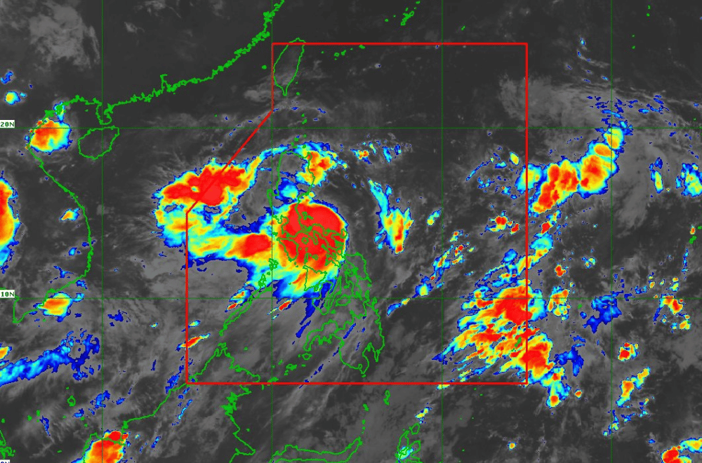
As of 5 a.m. of September 5, 2024, the center of #EntengPH was located over the coastal waters of Vinzons, Camarines Norte.
The storm is moving at a speed of 10 km/h in a west northwestward direction.
The storm currently has maximum sustained wins of 75 km/h near its center, with gustiness reaching up to 90 km/h.
Tropical Cyclone Wind Signal No. 2 has been raised over:
- Northeastern portion of Camarines Norte: Vinzons, San Lorenzo Ruiz, Talisay, Daet, Labo, Paracale, Jose Panganiban, San Vicente, Basud, Mercedes
- Northeastern portion of Camarines Sur: Garchitorena, Caramoan, Presentacion, San Jose, Lagonoy, Tinambac, Siruma
- Eastern portion of Cagayan: Pe, Gonzaga, Santa Teresita, Buguey, Lal-Lo, Gattaran, Baggao, Santa Ana, Lasam, Santo Niño, Alcala, Amulung, Solana, Iguig, Tuguegarao City, Enrile, Aparri, Ballesteros, Camalaniugan, Allacapan, Piat, Tuao, Rizal, Abulug, Pamplona
- Eastern portion of Isabela: Santa Maria, Santo Tomas, Cabagan, Delfin Albano, Quirino, Gamu, Burgos, Luna, Reina Mercedes, City of Cauayan, Alicia, Echague, Jones, San Agustin, Angadanan, San Guillermo, San Pablo, Maconacon, Tumauini, Ilagan City, Palanan, Divilacan, San Mariano, Naguilian, Benito Soliven, Dinapigue, Cabatuan, Aurora, San Manuel, Mallig, Quezon, Roxas
- Northern portion of Aurora: Casiguran, Dilasag, Dinalungan
- Polillo Islands
- Eastern portion of Quirino: Maddela
- Eastern portion of Kalinga: Rizal
Tropical Cyclone Wind Signal No. 1 has been raised over:
- Southern portion of Batanes: Sabtang, Ivana, Uyugan, Mahatao, Basco
- Eastern portion of Ilocos Norte: Nueva Era, Carasi, Vintar, Adams, Dumalneg, Pagudpud, Bangui
- Eastern portion of Abra: Tineg, Lacub, Malibcong
- Apayao
- Rest of Kalinga: Tanudan, City of Tabuk, Balbalan, Pinukpuk, Rizal, Lubuagan
- Eastern portion of Mountain Province: Barlig, Natonin, Paracelis
- Eastern portion of Ifugao: Banaue, Hingyon, Lagawe, Lamut, Mayoyao, Alfonso Lista, Aguinaldo
- Rest of Cagayan
- Rest of Isabela
- Rest of Quirino
- Eastern portion of Nueva Vizcaya: Alfonso Castaneda, Kasibu, Dupax del Norte, Bagabag, Diadi, Quezon, Villaverde, Solano, Bayombong, Ambaguio, Aritao, Bambang, Dupax del Sur
- Rest of Aurora
- Eastern portion of Nueva Ecija: General Tinio, Gabaldon, Palayan City, General Mamerto Natividad, Llanera, San Jose City, Carranglan, Pantabangan, Bongabon, Rizal, Laur
- Eastern portion of Bulacan: Doña Remedios Trinidad, Norzagaray
- Eastern portion of Rizal: Jala-Jala, Pililla, Tanay, Baras, City of Antipolo, Rodriguez, Teresa, Morong
- Eastern portion of Laguna: Luisiana, Majayjay, Magdalena, Pagsanjan, Santa Cruz, Lumban, Cavinti, Kalayaan, Paete, Siniloan, Santa Maria, Famy, Pangil, Mabitac, Pakil
- Northern and southern portions of Quezon: Tagkawayan, Guinayangan, Buenavista, San Narciso, Mulanay, San Andres, San Francisco, Lopez, Calauag, Catanauan, Gumaca, Macalelon, General Luna, Quezon, Alabat, Perez, General Nakar, Infanta, Real, Mauban, Unisan, Pitogo, Padre Burgos, Atimonan, Agdangan, Plaridel, Lucban, Sampaloc, City of Tayabas, Lucena City, Pagbilao
- Marinduque
- Rest of Camarines Norte
- Rest of Camarines Sur
- Albay
- Sorsogon
- Catanduanes
- Northern portion of Masbate: City of Masbate, Aroroy, Baleno
- Ticao and Burias Islands
Heavy Rainfall Outlook:
Heavy rainfall is expected in various areas due to #EntengPH.
On September 2, areas including Camarines Norte, Camarines Sur, Albay, Polillo Island, and southern Quezon may see over 200 mm of rain.
For September 3, Isabela, Cagayan, Abra, Apayao, and Ilocos Norte are forecasted to receive 100-200 mm.
By Wednesday, September 4, rainfall of 100-200 mm is anticipated in Babuyan Islands, Apayao, Abra, Ilocos Norte, and Ilocos Sur. Higher rainfall amounts are likely in elevated or mountainous regions, increasing the risk of flooding and landslides.
Severe Winds:
Wind Signal No. 2 warns of minor to moderate impacts from strong winds in affected areas, while Wind Signal No. 1 indicates minimal to minor impacts.
The storm may also bring strong to gale-force gusts across Luzon and Visayas, with potential impacts intensified by the Southwest Monsoon.
Hazards Affecting Coastal Waters:
In the next 24 hours, #EntengPH and the Southwest Monsoon are expected to create hazardous sea conditions. Gale warnings are in effect for the eastern seaboard of Luzon and southern Luzon, making sea travel risky for small vessels.
Moderate to rough seas will affect northern Luzon and parts of the western seaboard, while slight to moderate seas are expected elsewhere. Mariners should exercise caution, especially when using small or inadequately equipped boats.
Track and Intensity Outlook:
#EntengPH is projected to move northwestward over the next 24 hours, with potential landfall in Isabela or Cagayan later on September 2. The storm might also impact Babuyan Islands. Expected to decelerate and intensify over the Luzon Strait, #EntengPH could reach typhoon strength by September 5 or 6.
It is anticipated to exit the Philippine Area of Responsibility by September 5, early morning. Further westward shifts in its track could lead to increased rainfall across mainland Luzon.
