

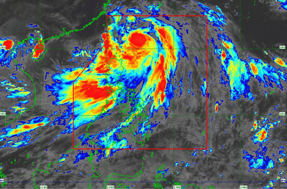
As of 5 p.m. on July 23, 2024, Typhoon “Carina” continues to strengthen while heading northward over the Philippine Sea, according to the Department of Science and Technology - Philippine Atmospheric, Geophysical and Astronomical Services Administration (DOST-PAGASA).
Typhoon “Carina,” currently 325 km east-northeast of Basco, Batanes, is intensifying with maximum sustained winds of 150 km/h and gusts up to 185 km/h.
Moving northward at 20 km/h, the typhoon is expected to reach northern Taiwan between the night of July 24 and morning of July 25 before exiting the Philippine Area of Responsibility (PAR).
TROPICAL CYCLONE WIND SIGNALS (TCWS)
TCWS No. 2: Batanes. Expect winds over 62 km/h, with possible minor to moderate impacts.
TCWS No. 1: Cagayan, Babuyan Islands, eastern Isabela, northern Apayao, and northern Ilocos Norte. Minimal to minor impacts from strong winds are anticipated.
RAINFALL FORECAST
From July 23 until the afternoon of July 24, areas including Batanes, Babuyan Islands, northern and eastern Cagayan, and Ilocos Sur are forecasted to receive 100-200 mm of rain. Other areas like Ilocos Norte, La Union, Abra, Benguet, and Apayao can expect 50-100 mm.
The Southwest Monsoon, intensified by Carina, will also bring moderate to intense rainfall to western Luzon until July 25.
GALE WARNING
A gale warning is in effect for Batanes, Babuyan Islands, and northeastern Cagayan. Sea travel is risky, particularly for small craft.
Rough seas, ranging from 2.5 to 4.0 meters, are expected over the northern and eastern seaboards of Northern Luzon, and the eastern seaboard of Central Luzon. Moderate to rough seas, between 2.0 and 3.5 meters, are also expected over southern Luzon, Visayas, and eastern Mindanao.
PAGASA advised residents in areas under TCWS No. 2 to prepare for power outages, secure fishing boats, and elevate household items to prevent flood damage.
Residents are urged to monitor the latest Severe Weather Bulletin from PAGASA every six hours and stay updated with hourly forecasts.
