


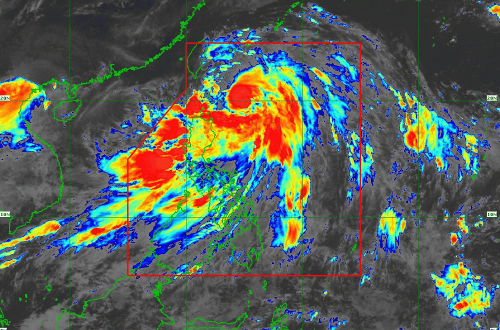
As of 11 a.m. on July 23, 2024, Typhoon "Carina" has slightly intensified as it moves northward over the Philippine Sea, according to the Department of Science and Technology - Philippine Atmospheric, Geophysical and Astronomical Services Administration (DOST-PAGASA).
The center of Typhoon Carina is approximately 320 km east of Basco, Batanes, moving westward at 15 km/h. It has maximum sustained winds of 140 km/h near the center, with gusts up to 170 km/h.
Typhoon Carina is currently moving north-northwestward at 15 km/h and is forecasted to accelerate gradually before turning northwestward on July 25.
TROPICAL CYCLONE WIND SIGNALS (TCWS)
Tropical Cyclone Wind Signal No. 2 is raised over Batanes (Itbayat, Basco, Mahatao, Uyugan, Ivana), where winds greater than 62 km/h up to 88 km/h are expected within 24 hours.
PAGASA advised residents to prepare for power outages, secure fishing boats, and elevate household items to prevent flood damage.
Signal No. 1 is raised for the remaining areas of Batanes, Cagayan including Babuyan Islands, eastern Isabela, northern Apayao, northern Ilocos Norte, northern Aurora, Polillo Islands, Calaguas Islands, and northern Catanduanes.
PAGASA urged residents to monitor the latest Severe Weather Bulletin from PAGASA every six hours and stay updated with hourly forecasts.
HEAVY RAINFALL
Heavy rainfall is expected from July 24 until July 25 noon, with 100-200 mm forecasted for Batanes, Babuyan Islands, the northern and eastern portions of Mainland Cagayan, and Ilocos Sur. Ilocos Norte, La Union, Abra, Benguet, Apayao, eastern Isabela, and the rest of Cagayan can expect 50-100 mm of rainfall.
On July 25, Batanes is forecasted to receive 100-200 mm, while the Babuyan Islands will get 50-100 mm.
On July 26, Batanes will receive another 50-100 mm.
The enhanced Southwest Monsoon will bring moderate to intense rainfall to western Luzon through July 26.
GALE WARNING
A Gale Warning is in effect for Batanes and the Babuyan Islands, making sea travel risky for small vessels. Rough seas, ranging from 2.5 to 4.0 meters, are expected over the northern and eastern seaboards of Northern Luzon, and the eastern seaboard of Central Luzon. Moderate to rough seas, between 2.0 and 3.5 meters, are also expected over southern Luzon, Visayas, and eastern Mindanao.
Minor to moderate impacts from strong winds are possible in areas under Wind Signal No. 2, while minimal to minor impacts are expected in areas under Wind Signal No. 1.
