

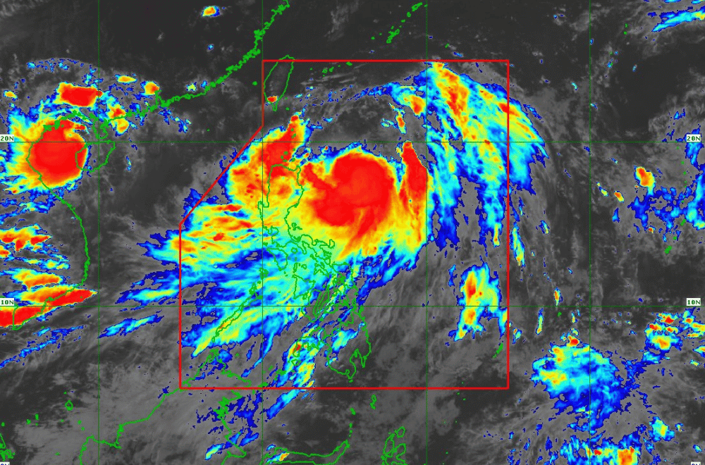
As of 5 p.m. on July 22, 2024, Typhoon "Carina" is intensifying and moving slowly, bringing heavy rains and strong winds to parts of Northern Luzon, according to the Department of Science and Technology - Philippine Atmospheric, Geophysical and Astronomical Services Administration (DOST-PAGASA).
It is located 420 km east of Tuguegarao City, Cagayan, with maximum sustained winds of 120 km/h and gusts reaching up to 150 km/h.
Areas under Wind Signal No. 1 may experience minimal to minor wind impacts. Strong to gale-force gusts are expected in the coastal and upland areas of Zambales, Bataan, Aurora, Metro Manila, CALABARZON, MIMAROPA, Bicol Region, and Visayas today.
By July 23, this will extend to the Ilocos Region, Zamboanga Peninsula, and Davao Region. On Wednesday, strong winds will also impact Abra, Benguet, Apayao, Nueva Vizcaya, Quirino, Isabela, Central Luzon, Northern Samar, and parts of Samar.
Coastal waters are expected to be hazardous over the next 24 hours, with moderate to rough seas forecasted along the northern and eastern seaboards of Luzon and western seaboards of Central and Southern Luzon, and Western Visayas.
Typhoon Carina is projected to move north-northwestward until tomorrow, gradually accelerating before turning northwestward.
It is expected to exit the Philippine Area of Responsibility by evening of July 24 or early morning of July 25.
The typhoon will then likely pass near the southern Ryukyu Islands and close to northern Taiwan before moving towards southeastern China over the East China Sea.
PAGASA advised residents to inspect their homes for necessary repairs, clean drainage systems, harvest crops that can be yielded, and monitor PAGASA’s Severe Weather Bulletins for updates every six hours.
(via DOST-PAGASA)
