

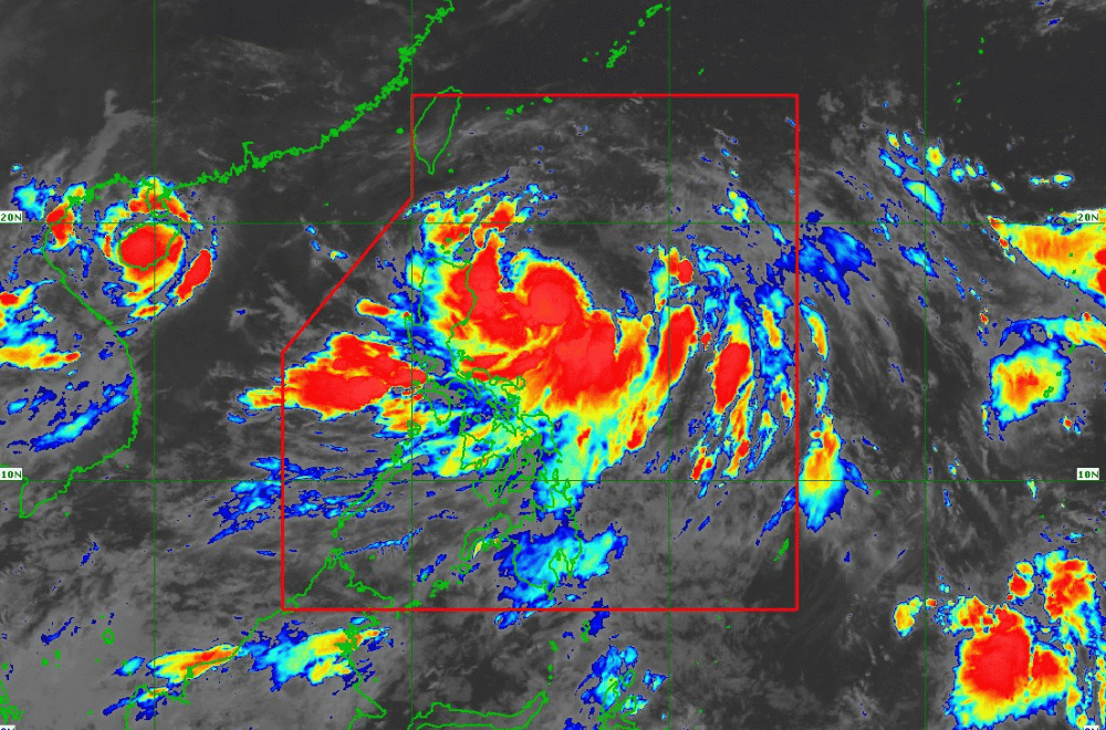
As of 5 a.m. on July 22, 2024, Severe Tropical Storm "Carina" is intensifying and moving slowly, bringing heavy rains and strong winds to parts of Northern Luzon, according to the Department of Science and Technology - Philippine Atmospheric, Geophysical and Astronomical Services Administration (DOST-PAGASA).
It is located 420 km east of Tuguegarao City, Cagayan, with maximum sustained winds of 100 km/h and gusts up to 125 km/h.
Areas under Wind Signal No. 1 may experience minimal to minor wind impacts. Strong to gale-force gusts are expected on:
July 22: MIMAROPA, Bicol Region, Western Visayas, Northern Samar, northern portion of Samar.
July 23: Zambales, Bataan, Aurora, Metro Manila, CALABARZON, Bicol Region, Visayas.
July 24: Ilocos Region, Abra, Benguet, Nueva Vizcaya, Quirino, Central Luzon, Metro Manila, CALABARZON, MIMAROPA, Bicol Region, Visayas.
Moderate to rough seas, ranging from 1.5 to 3.0 meters, are expected over the northern and eastern seaboards of Northern Luzon. Mariners of small sea crafts and motorbancas are advised not to venture out. Moderate seas, ranging from 1.5 to 2.5 meters, are also expected over the seaboards of Central and Southern Luzon, as well as the eastern seaboards of Visayas and Mindanao.
STS "Carina" is forecast to move north-northwestward until July 24, accelerating gradually before turning northwestward.
It is expected to exit the Philippine Area of Responsibility (PAR) by evening of July 24 or early morning of July 25, passing near or over the southern Ryukyu Islands and close to northern Taiwan.
STS "Carina" is likely to reach typhoon category within 24 hours.
PAGASA advised residents to inspect and repair homes, clean drainage systems, and monitor PAGASA updates every six hours.
