

Coast Guard on 'high alert' in North Luzon due to Carina
The Philippine Coast Guard (PCG) has placed its personnel in north eastern Luzon on “high alert” to prepare for the impact of Severe Tropical Storm (STS) Carina (international name: Gaemi).
Coast Guard District North Eastern Luzon (CGDNELZN) Commander, CG Captain Ludovico Librilla Jr., instructed all coast guard stations and sub-stations to maintain readiness by activating their deployable response groups, and preparing their search and rescue boats, vehicles, and gears.
The PCG also reminded the public to observe safety precautionary measures.
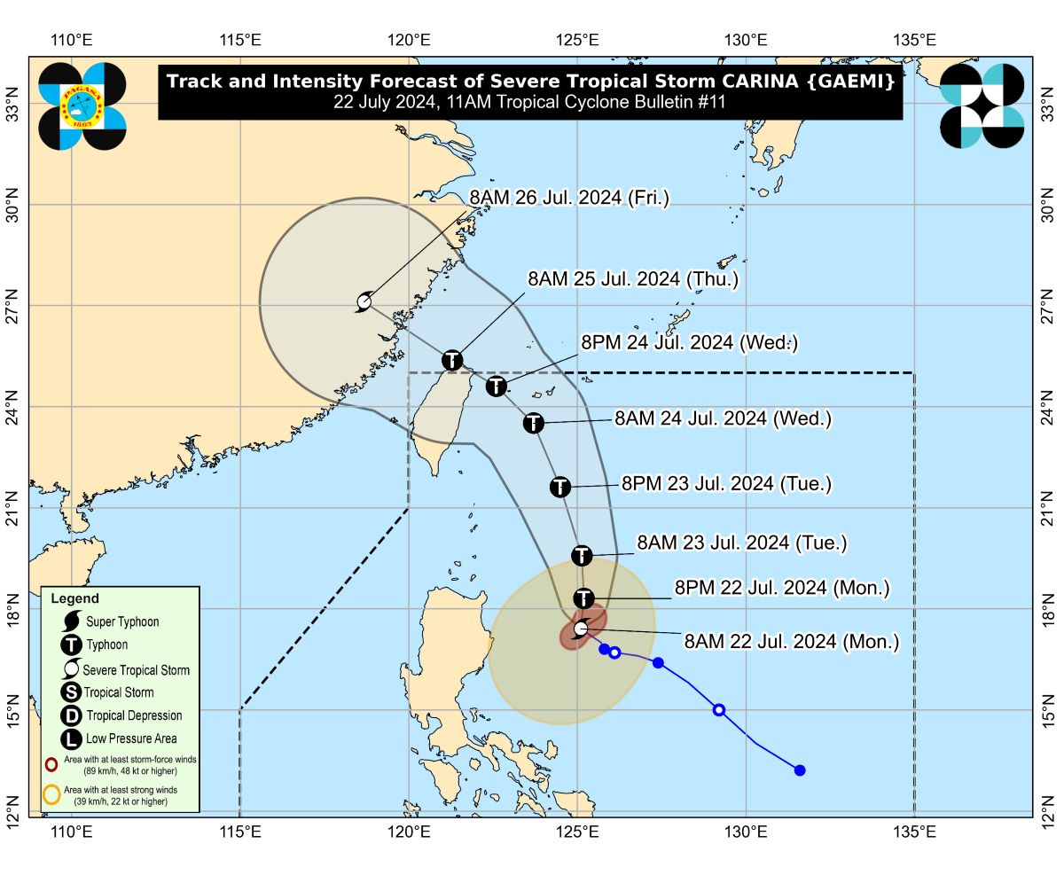
In its 11 a.m. advisory, state weather bureau PAGASA said Tropical Cyclone Wind Signal (TCWS) No. 1 remained over parts of northern Luzon as Carina continued to steadily intensify as it moved northwestward over the Philippine Sea.
PAGASA said areas under Signal No. 1 are:
- Eastern portion of mainland Cagayan (Santa Ana, Gattaran, Baggao, Peñablanca, Lal-Lo, Gonzaga), including the eastern portion of Babuyan Islands (Camiguin Island, Babuyan Islands)
- Northeastern portion of Isabela (Divilacan, Palanan, Maconacon)
PAGASA warned that these areas would experience winds ranging from 39 kph to 61 kph in at least 36 hours or intermittent rains.
According to the weather bureau, the center of Carina's eye was estimated at 340 kms. east northeast of Casiguran, Aurora.
The tropical cyclone was moving northwestward at 15 kph, packing maximum sustained winds of 110 kph near the center and gustiness of up to 135 kph.
Carina was expected to move generally northward from Monday to Tuesday while gradually accelerating before turning northwestward.
PAGASA said would will remain far from the country's landmass and may exit the Philippine area of responsibility on Wednesday evening or Thursday early morning.
Carina was also forecast to intensify to a typhoon within 12 hours. — RSJ, GMA Integrated News
