

Magnitude 7.4 earthquake strikes off Hinatuan, Surigao del Sur
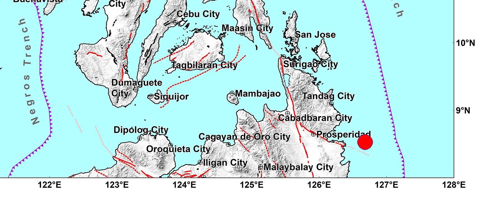
A magnitude 7.4 earthquake struck off the coast of Hinatuan, Surigao del Sur, on Saturday evening, the Philippine Institute of Volcanology and Seismology (PHIVOLCS) said.
The earthquake, which was initially measured at magnitude 6.9, occurred at 10:37 p.m. at a depth of 25 kilometers.
Its epicenter was located 30 kilometers northeast of Hinatuan town.
The reported intensities are the following:
- Intensity VII - City of Tandag, Surigao del Sur
- Intensity VI - City of Bislig, Surigao del Sur
- Intensity V - Cagayan de Oro City; Nabunturan, Davao de Oro; Davao City
- Intensity IV - Duero, and Garcia Hernandez, Bohol; Mandaue City, Cebu; Alangalang, Baybay City, Burauen, Dulag, Hilongos, Jaro, Javier, Julita, La Paz, Macarthur, Mahaplag, Mayorga, Palo, Pastrana, Santa Fe, Tanauan, and Tolosa, Leyte; Tacloban City; Anahawan, Bontoc, Hinunangan, Hinundayan, Liloan, Limasawa, Malitbog, Padre Burgos, San Francisco, San Juan, Silago, and Sogod, Southern Leyte; Alabel, and Malungon, Sarangani; Tupi, South Cotabato; Surigao City, Surigao del Norte
- Intensity III - Tagbilaran City, Bohol; Leyte, Leyte; Dapitan CIty, Zamboanga Del Norte; Molave, Zamboanga del Sur; San Fernando, Bukidnon; Kidapawan City, Cotabato; Glan, Kiamba, Maasim, and Malapatan, Sarangani; Banga, and City of Koronadal, South Cotabato; General Santos City; President Quirino, Sultan Kudarat; Datu Odin Sinsuat, and Sultan Kudarat, Maguindanao; Cotabato City
- Intensity II - Argao, Cebu; Calubian, Leyte; Dipolog City, Zamboanga del Norte; Santo Niño, South Cotabato; Esperanza, and Kalamansig, Sultan Kudarat
- Intensity I - Lake Sebu, South Cotabato
PHIVOLCS expects damage and aftershocks following the earthquake.
The strong earthquake also caused PHIVOLCS to issue a tsunami alert.
PHIVOLCS said the first tsunami waves would arrive between 10:37 p.m. and 11:59 p.m.
''These waves may continue for hours,'' it said.
''Based on the local tsunami scenario database, it is expected to experience wave heights of more than one meter above the normal tides and may be higher on enclosed bays and straits. Destructive tsunami is expected with life-threatening wave heights.''
With this development, PHIVOLCS ''strongly advised'' people living in the coastal areas of Surigao del Sur and Davao Oriental ''to immediately evacuate to higher grounds or move farther inland.''
''Owners of boats in harbors, estuaries, or shallow coastal waters of the above-mentioned provinces should secure their boats and move away from the waterfront. Boats already at sea during this period should stay offshore in deep waters until further advised,'' PHIVOLCS said.
PHIVOLCS later lifted the tsunami warning at 3:23 a.m. Sunday.
"Sea level monitoring stations confirmed the occurrence of tsunami with preliminary wave heights of 0.64 meter in Mawes Island, Hinatuan, 0.18 meter in Lawigan, Bislig City, 0.05 meter in Port of Dapa, Surigao del Norte and 0.08 meter in Mati, Davao Oriental," said PHIVOLCS in an advisory issued at 3:23 a.m.
"The last recorded tsunami wave arrival in the Philippines occurred at 02:52 AM (PST) at Hinatuan-Bislig Bay Station on Mawes Island. This means that the tsunami threat associated with this earthquake has now largely passed the Philippines," the agency added.
PHIVOLCS has canceled the warning and advised local governments to assess the situation in their areas.
On November 17, a magnitude 6.8 earthquake hit Davao Occidental, killing nine people and affecting thousands of families. —VBL/BAP/KG, GMA Integrated News
