

PAGASA: Two cyclones in PAR to enhance Southwest Monsoon
Two cyclones are inside the Philippine Area of Responsibility after Tropical Storm Helen entered the PAR just as Tropical Depression Gener moved away.
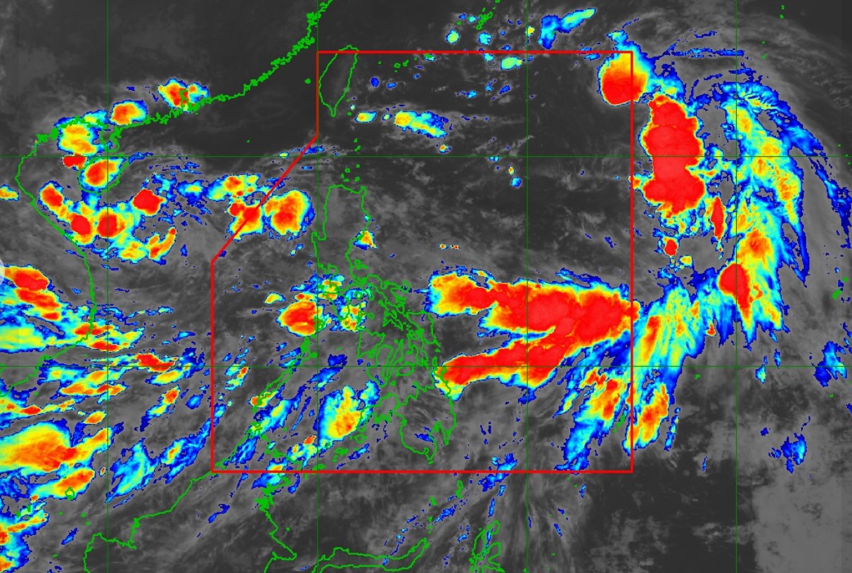
According to the 11 p.m. tropical cyclone bulletins on Gener and Helen, the weather disturbances will enhance the Southwest Monsoon.
PAGASA in its weather advisory issued at 11 p.m. said heavy to intense rain caused by the Southwest Monsoon is expected in Palawan, Occidental Mindoro, and Antique from Tuesday night to Wednesday evening.
Over the same period, moderate to heavy rain is seen over Metro Manila, the rest of MIMAROPA, the rest of Western Visayas, the Ilocos Region, Cordillera Administrative Region, Zambales, Bataan, Batangas, and Cavite.
PAGASA said the Southwest Monsoon enhanced by Gener and Helen will also bring strong to gale-force gusts on Tuesday in Batanes, MIMAROPA, Bicol Region, Visayas, and Mindanao, especially in coastal and upland areas exposed to winds.
The conditions are expected on Wednesday in Zambales, Bataan, Pampanga, Bulacan, Metro Manila, CALABARZON, MIMAROPA, Bicol Region, Visayas, and Mindanao.
READ: Class suspensions for Wednesday, September 18, 2024
Helen enters PAR
Helen (international name: Pulasan) entered the PAR at 6:30 p.m., PAGASA said.
At 10 p.m., the center of Helen was estimated at 1,290 km east of extreme Northern Luzon.
It had maximum sustained winds of 85 kph near the center, gustiness of up to 105 kph, and central pressure of 992 hPa.
Helen was seen moving westward at 40 kph.
It had strong to gale-force winds extending outwards up to 650 km from the center.
PAGASA forecasts Helen to move generally west-northwestward for the next 48 hours and may exit the PAR on Wednesday afternoon.
"Throughout the forecast period, Helen will remain far from the Philippine landmass and will not directly affect any part of the country," PAGASA said.
Gener leaving PAR
At 10 p.m. Gener was estimated 355 km west of Bacnotan, La Union.
It had maximum sustained winds of 55 kph near the center, gustiness of up to 70 kph, and central pressure of 996 hPa.
Gener was seen moving westward at 25 kph.
It had strong winds extending outwards up to 480 km from the center.
PAGASA said Gener would leave the PAR either on Tuesday night or Wednesday early morning.
It said Gener outside the PAR would continue to move westward over the West Philippine Sea for the remainder of the forecast period.
Gener is forecast to have a limited intensification although it may reach tropical storm category by Wednesday morning. —NB, GMA Integrated News
