Signal No. 2 up over Batanes as Ofel weakens further

Tropical Cyclone Wind Signal (TCWS) No. 2 was raised over Batanes as Ofel weakened into severe tropical storm over the Luzon Strait on Friday morning, according to state weather bureau PAGASA.
In its 11 a.m. bulletin, PAGASA also said TCWS No. 1 is raised over the following areas in Luzon:
- the northern portion of Cagayan (Pamplona, Claveria, Abulug, Sanchez-Mira, Santa Praxedes, Ballesteros)
- Babuyan Islands
- the northern portion of Apayao (Luna, Santa Marcela, Calanasan)
- the northern portion of Ilocos Norte (Pagudpud, Adams, Bangui, Dumalneg, Burgos, Pasuquin, Vintar, Bacarra, Piddig, Carasi)
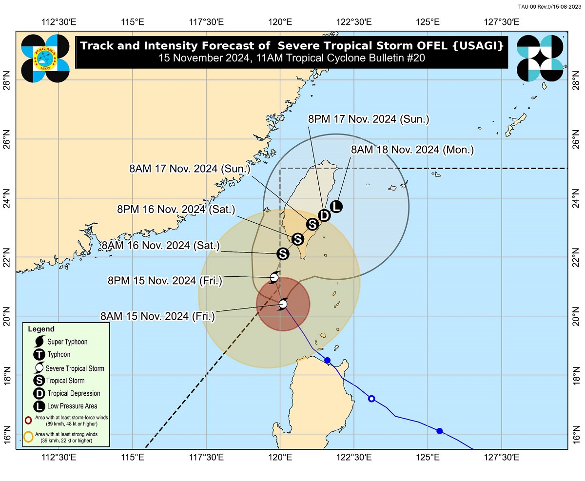
PAGASA said Ofel was last spotted located 215 kilometers northwest of Calayan, Cagayan or 195 kilometers west of Itbayat, Batanes moving north northwestward at 20 kilometers per hour (kph).
The severe tropical storm was packing maximum sustained winds of 110 kph near the center and gustiness of up to 135 kph.
PAGASA said Ofel may exit the Philippine area of responsibility (PAR) on Friday afternoon but may re-enter.
“OFEL will continue to move north northwestward and may briefly exit the northwestern boundary of PAR this afternoon. Outside PAR, the tropical cyclone will then move generally northward until tomorrow (16 November) early morning over the sea west of Batanes,” it said.
“OFEL may then re-enter the PAR region as it turns generally northeastward towards southern Taiwan and will remain inside PAR until the rest of the forecast period,” it added.
Despite Ofel’s exit from PAR, PAGASA noted that TCWS may still be raised over the areas of Extreme Northern Luzon. —KBK, GMA Integrated News


