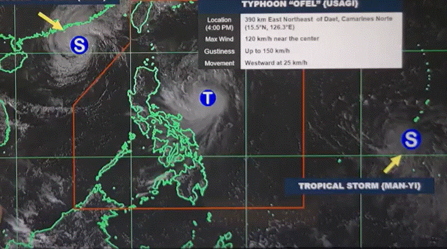
Ofel to intensify within 24 hours, 3 areas under Signal No. 2

Three areas have been placed under Signal No. 2 as Typhoon Ofel moves west northwestward over Northern Luzon.
According to PAGASA’s 5 p.m. cyclone bulletin on Wednesday, Ofel was last seen 480 kilometers east of Baler, Aurora with maximum sustained winds of 120 km/hand gustiness of up to 150 km/h.
The following areas under Signal No. 2 will face winds of 62 km/h up to 88 km/h in at least 24 hours:
- Cagayan including Babuyan Islands
- the northern and eastern portions of Isabela (Maconacon, Divilacan, Palanan, San Pablo, Cabagan, Santa Maria, Santo Tomas, Tumauini, Ilagan City)
- the eastern portion of Apayao (Flora, Luna, Santa Marcela, Pudtol)
The following areas under Signal No. 1 will experience winds of 39 km/h to 61 km/h or intermittent rains within the next 36 hours:
- Batanes
- The rest of Isabela
- Quirino
- The northern portion of Nueva Vizcaya (Kasibu, Ambaguio, Solano, Bayombong, Quezon, Bagabag, Diadi, Villaverde)
- Apayao
- Kalinga
- Abra
- Mountain Province
- Ifugao
- Ilocos Norte
- The northern portion of Aurora (Dilasag, Casiguran, Dinalungan, Dipaculao)
Ofel is predicted to make landfall over the eastern coast of Cagayan or Isabela by Thursday afternoon.
It may continue through the Luzon Strait by Friday, and either pass or make another landfall over the Babuyan Islands on Saturday.
“Regardless of the position of the landfall point, it must be emphasized that hazards on land and coastal waters may still be experienced in areas outside the landfall point or forecast confidence cone,” the advisory read.
Typhoon Ofel may continue to intensify and make landfall within the next 24 hours, before entering a weakening trend throughout the rest of its forecast period. —LDF, GMA Integrated News


