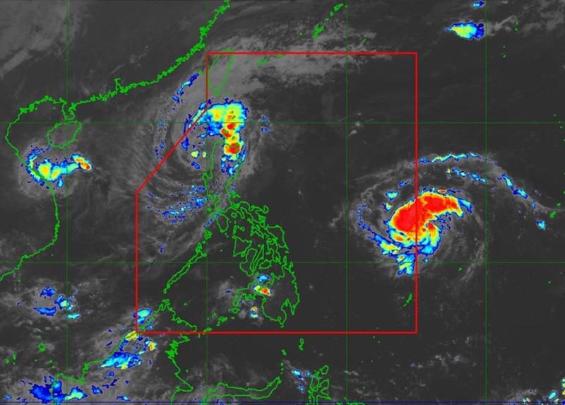
Nika maintains strength, Signal No. 2 hoisted over 3 areas

Signal No. 2 was hoisted over three areas in Luzon as Severe Tropical Storm Nika maintains strength over the West Philippine Sea, PAGASA said late Monday evening.
The state weather bureau also reported that the Tropical Depression outside the Philippine Area of Responsibility (PAR) has intensified into a Tropical Storm.
According to the 11 p.m. PAGASA tropical cyclone bulletin, Severe Tropical Storm Nika has maximum sustained winds of 110 km/h near the center and gustiness of up to 150 kph.
Signal No. 2 was raised over Ilocos Norte, Ilocos Sur, and Abra.
These areas are expected to experience winds of greater than 62 kph and up to 88 kph in at least 24 hours, which may cause light to moderate damage to high risk structures.
The following areas are under Signal No. 1:
- La Union
- the northwestern portion of Pangasinan (Bolinao, Bani, City of Alaminos, Agno, Sual, Anda)
- Apayao
- Kalinga
- Mountain Province
- Ifugao
- Benguet
- Cagayan including Babuyan Islands
- the northwestern portion of Isabela (San Pablo, Santa Maria, Cabagan, Santo Tomas, Quezon, Delfin Albano, Mallig, Roxas, San Manuel, Aurora, Quirino, Burgos, Tumauini, Gamu, San Mateo, Luna, Reina Mercedes, Cabatuan, Ilagan City)
At 10 p.m., Nika was monitored over the coastal waters of Cabugao, Ilocos Sur moving northwestward at 30 kph.
PAGASA also warned of strong to gale-force gusts over the coastal and upland areas of Ilocos Sur, La Union, Pangasinan, Batanes, Cagayan including Babuyan Islands, and Isabela on Tuesday due to northeasterly wind flow.
A minimal to moderate storm surge may also occur in the next 48 hours in the low-lying or exposed coastal localities of Ilocos Sur, La Union, Pangasinan, and Zambales.
A Gale Warning is hoisted over the Northern Luzon and the eastern seaboard of Central Luzon.
PAGASA said Nika is seen to continue moving west northwestward over West Philippine Sea and exit the Philippine Area of Responsibility (PAR) by Tuesday morning.
“Nika will continue to weaken for the next days and may become a remnant low over the sea near southern China. Nevertheless, it will remain as a severe tropical storm throughout its passage within the PAR region,” PAGASA said.
Tropical Storm outside PAR
The center of the Tropical Storm was estimated at 1,185 kilometers east of Eastern Visayas outside PAR packing maximum sustained winds of 65 kilometers per hour near the center, gustiness of up to 80 kph, and central pressure of 1000 hPa.
The Tropical Storm is moving westward at the speed of 35 kph with strong to gale-force winds extend outwards up to 190 km from the center.
General outlook
PAGASA said that the tropical storm will enter the PAR on Tuesday morning and will be named Ofel.
"Within the PAR region, the tropical cyclone will move west northwestward. On the forecast track, it may make landfall over Northern or Central Luzon on Thursday (14 November) afternoon or evening," PAGASA also reported. — Mariel Celine Serquiña/BAP, GMA Integrated News


