Nika traverses Northern Luzon, Signal No. 4 still up over 7 areas

Tropical Cyclone Wind Signal (TCWS) No. 4 is in effect over seven areas in Luzon as Typhoon Nika traverses Northern Luzon, according to state weather bureau PAGASA Monday.
In its 11 a.m. bulletin, PAGASA said Tropical Cyclone Wind Signals are raised in the following areas:
TCWS No. 4
- the northernmost portion of Aurora (Dilasag, Casiguran)
- the central and southern portions of Isabela (Dinapigue, San Mariano, San Guillermo, Jones, Echague, Ramon, San Isidro, City of Santiago, Cordon, Roxas, Burgos, Reina Mercedes, Naguilian, Benito Soliven, Gamu, San Manuel, Aurora, San Mateo, Cabatuan, Alicia, Luna, City of Cauayan, Angadanan, Quezon, Mallig, Quirino, Ilagan City, Delfin Albano, San Agustin)
- Kalinga
- Mountain Province
- the northern portion of Ifugao (Aguinaldo, Mayoyao, Alfonso Lista, Banaue, Hungduan, Hingyon, Lagawe)
- the central and southern portion of Abra (Manabo, Pidigan, San Juan, Tayum, Langiden, Luba, Boliney, Sallapadan, Bucloc, Lagangilang, Tubo, Danglas, Villaviciosa, La Paz, Licuan-Baay, Pilar, Malibcong, Pe, San Isidro, Daguioman, San Quintin, Dolores, Lagayan, Bangued, Bucay, Lacub)
- the northern and central portions of Ilocos Sur (Cabugao, Sinait, San Juan, San Emilio, Lidlidda, Banayoyo, Santiago, San Esteban, Burgos, Santa Maria, Magsingal, San Vicente, Santa Catalina, Nagbukel, San Ildefonso, City of Vigan, Caoayan, Santa, Bantay, Santo Domingo, Narvacan, Quirino, Cervantes, Sigay, Salcedo, Santa Lucia, City of Candon, Galimuyod, Gregorio del Pilar, Santa Cruz)
TCWS No. 3
- the central portion of Aurora (Dinalungan)
- the northern portion of Quirino (Diffun, Cabarroguis, Aglipay, Saguday, Maddela)
- the northeastern portion of Nueva Vizcaya (Diadi, Bagabag, Quezon, Solano, Villaverde, Kasibu, Ambaguio, Bayombong)
- the rest of Isabela
- the southwestern portion of Cagayan (Enrile, Solana, Tuao, Tuguegarao City, Rizal, Piat)
- the southern portion of Apayao (Conner, Kabugao)
- the rest of Abra
- the rest of Ifugao
- the northern portion of Benguet (Buguias, Mankayan, Bakun)
- the southern portion of Ilocos Norte (Laoag City, Sarrat, San Nicolas, Piddig, Marcos, Nueva Era, Dingras, Bacarra, Solsona, Paoay, Currimao, Pinili, Badoc, City of Batac, Banna)
- the rest of Ilocos Sur
TCWS No. 2
- the northwestern and eastern portions of Cagayan (Iguig, Peñablanca, Baggao, Alcala, Amulung, Santo Niño, Gattaran, Lasam, Santa Praxedes, Claveria, Sanchez-Mira, Pamplona, Abulug, Allacapan, Ballesteros, Lal-Lo, Aparri, Camalaniugan, Buguey, Santa Teresita, Gonzaga)
- the rest of Nueva Vizcaya
- the rest of Quirino
- the rest of Apayao
- the rest of Benguet
- the rest of Ilocos Norte
- La Union
- the northeastern portion of Pangasinan (San Nicolas, Natividad, San Quintin, Sison, San Manuel, Umingan, Tayug)
- the central portion of Aurora (Dipaculao, Maria Aurora, Baler)
- the northern portion of Nueva Ecija (Carranglan, Pantabangan, Lupao, San Jose City)
TCWS No. 1
- Babuyan Islands
- the rest of mainland Cagayan
- the rest of Pangasinan
- the rest of Aurora
- the rest of Nueva Ecija
- Bulacan
- Pampanga
- Tarlac
- the northern and central portions of Zambales (Santa Cruz, Candelaria, Masinloc, Palauig, Iba, Botolan, Cabangan, San Marcelino, San Felipe, San Narciso)
- Metro Manila
- Rizal
- the eastern portion of Laguna (Santa Maria, Mabitac, Pakil, Pangil, Famy, Siniloan, Paete, Kalayaan, Cavinti, Lumban, Luisiana, Santa Cruz, Magdalena, Pagsanjan, Pila)
- the northern and eastern portions of Quezon (Infanta, Sampaloc, Mauban, Real, General Nakar) including Pollilo Islands
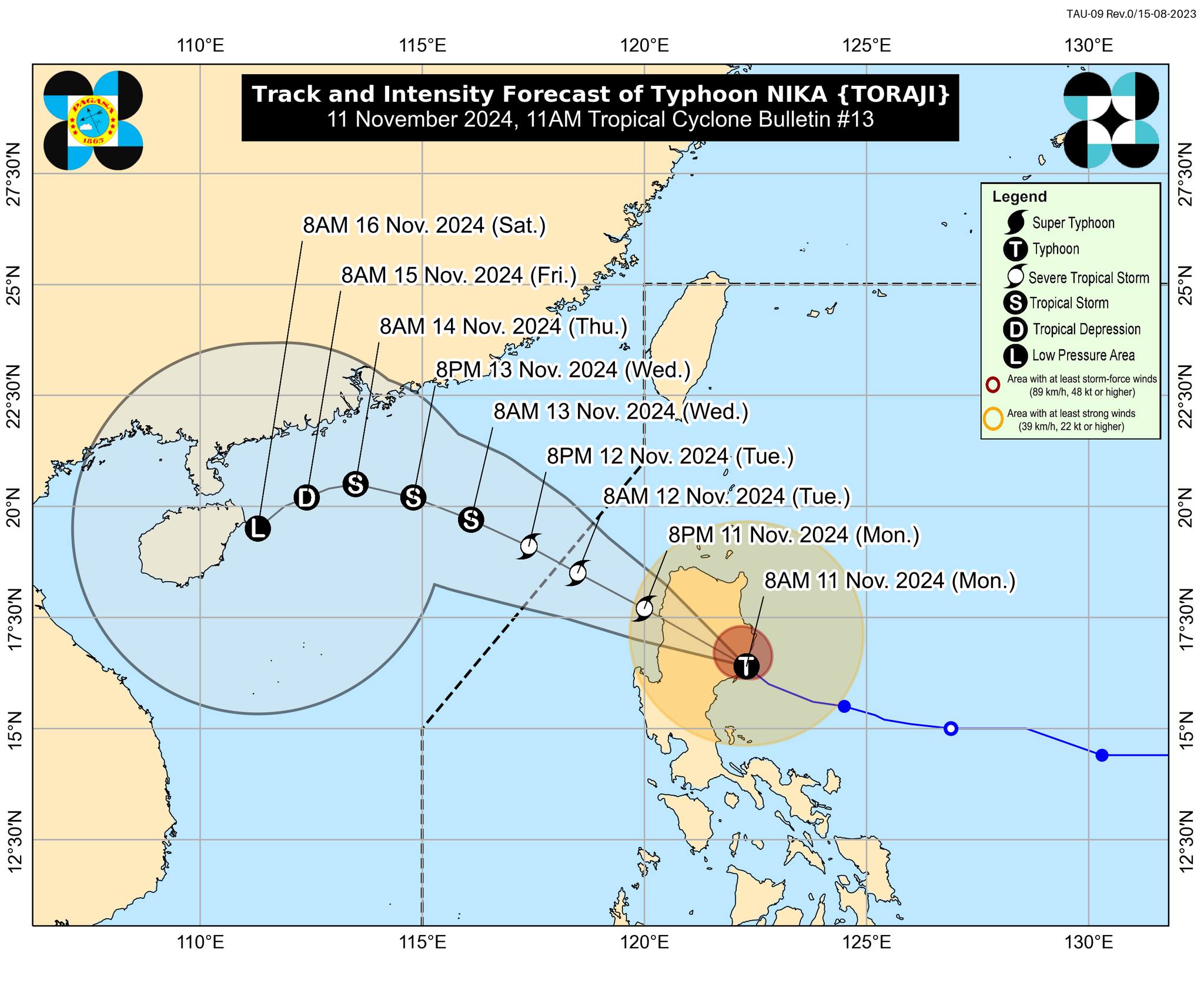
The center of Nika was located in the vicinity of San Agustin, Isabela moving northwestward at 25 kilometers per hour (kph) with maximum sustained winds of 130 kph near the center and gustiness of up to 160 kph.
“NIKA will traverse the landmass of mainland Luzon today and emerge over the sea west of Ilocos Sur this afternoon or evening,” PAGASA said.
“This tropical cyclone may weaken into a severe tropical storm while traversing mainland Luzon due to land interaction,” it added.
Nika is expected to exit the Philippine area of responsibility (PAR) by Tuesday morning or afternoon, according to PAGASA.
It made a landfall in the vicinity of Dilasag, Aurora at 8:10 a.m., Monday,
Some areas have suspended classes due to the bad weather brought by Nika.
Mayors and governors in Ilocos Region, Cagayan Valley and Cordillera Administrative Region were ordered by the Department of the Interior and Local Government to conduct preemptive evacuation.
Meanwhile, the Metropolitan Manila Development Authority suspended the expanded number coding on Monday, November 11, due to Nika.
Ofel
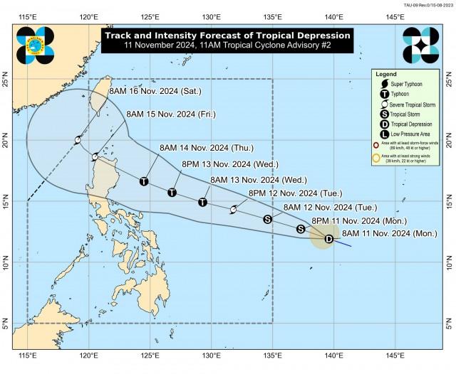
Meanwhile, the tropical depression that is expected to enter PAR on Tuesday and will be named “Ofel” intensified on Monday morning, PAGASA said in a separate 11 a.m. advisory.

The tropical depression was moving west northwestward at a “fast pace” at 35 kph.
“On the forecast track, the TD may make landfall over Northern or Central Luzon on Thursday (14 November) evening or Friday (15 November) early morning,” PAGASA said.
“This tropical cyclone is forecast to steadily intensify in the next three days and reach typhoon category on Wednesday. It may also hit land at or near its peak intensity,” it added.—AOL, GMA Integrated News


