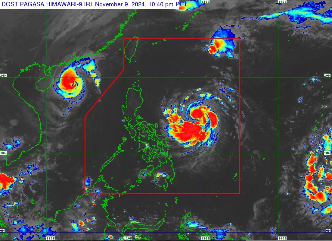
Nika gathers strength, moves westward

Tropical Storm Nika (international name: Toraji) has further intensified as it moves westward over the Philippine Sea east of the Bicol Region, PAGASA said late Saturday evening.
In its 11 p.m. tropical cyclone bulletin, PAGASA said Nika has maximum sustained winds of 75 km/h near the center and gustiness of up to 90 km/h.
At 10 p.m., Nika was spotted 625 km east of Virac, Catanduanes or 750 km east of Daet, Camarines Norte, moving westward at 20 km/h.
The following areas are under Signal No. 1:
- Isabela
- Quirino
- the eastern portion of Nueva Vizcaya (Kasibu, Alfonso Castaneda, Dupax del Norte, Diadi, Quezon)
- Aurora
- the eastern portion of Nueva Ecija (Bongabon, Gabaldon, General Tinio, Laur)
- the eastern portion of Bulacan (Doña Remedios Trinidad, Norzagaray)
- the eastern portion of Quezon (Calauag, Guinayangan, Tagkawayan, Pitogo, San Andres, Buenavista, San Francisco, Pagbilao, Infanta, Lopez, Catanauan, Mulanay, Unisan, General Luna, Plaridel, Quezon, Alabat, Sampaloc, Padre Burgos, Macalelon, Mauban, Perez, Agdangan, Gumaca, Atimonan, Real, San Narciso, General Nakar) including Polillo Islands
- Camarines Norte
- Camarines Sur
- Catanduanes
- the northeastern portion of Albay (Malinao, Tiwi, Bacacay, City of Tabaco, Malilipot, Rapu-Rapu)
PAGASA said the highest wind signal that may be hoisted is Signal No. 3.
“However, the hoisting of Wind Signal No. 4 is also not ruled out,” the state weather bureau said.
The heavy rainfall forecast is as follows:
Saturday evening to Sunday evening
Moderate to Heavy (50 - 100 mm)
Catanduanes
Sunday evening to Monday evening
Intense to Torrential (>200 mm)
Isabela
Aurora
Heavy to Intense (100 – 200 mm)
Cagayan
Quirino
Moderate to Heavy (50 – 100 mm)
Cordillera Administrative Region
Nueva Vizcaya
Quezon
Camarines Norte
Camarines Sur
Catanduanes
Monday evening to Tuesday evening
Intense to Torrential (>200 mm)
Apayao
Kalinga
Heavy to Intense (100 – 200 mm)
Cagayan
Abra
Mountain Province
Ifugao
Ilocos Norte
Ilocos Sur
Moderate to Heavy (50 – 100 mm)
La Union
Benguet
Aurora
the rest of Cagayan Valley
PAGASA also warned of strong to gale-force gusts over the coastal and upland areas of Batanes and northern Cagayan including Babuyan Islands on Sunday due to the northeasterly wind flow.
''Forecast rainfall may be higher in mountainous and elevated areas. Moreover, impacts in some areas maybe worsened by significant antecedent rainfall,'' PAGASA said.
Before making landfall over Isabela or Aurora on Monday afternoon or evening, Nika is predicted to reach the severe tropical storm category on Sunday.
“Nika may reach its peak intensity prior to landfall, and the possibility of rapid intensification is not ruled out while this weather disturbance is over the Philippine Sea east of Quezon,” PAGASA said.
''A short period of weakening is expected as Nika traverses the landmass of Luzon due to land interaction, but Nika may be expected to remain a severe tropical storm throughout the forecast period,'' it said.
In another Facebook post, PAGASA said the low pressure area outside the Philippine Area of Responsibility has a “medium chance of developing into a tropical depression with the next 24 hours.''
At 8 p.m., the LPA was located 2,520 km east of Northeastern Mindanao. — Mariel Celine Serquiña/VBL, GMA Integrated News


