Marce exits PAR, LPA being monitored

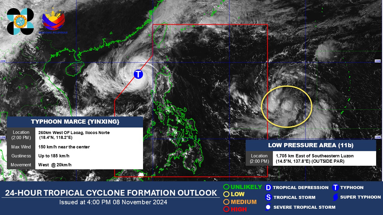
The center of the eye of Typhoon Marce exited the Philippine Area of Responsibility (PAR) at 4 p.m. Friday, state weather bureau PAGASA said.
According to PAGASA’s 5 p.m. cyclone bulletin, Marce was last observed at 285 kilometers west northwest of Sinait, Ilocos Sur with maximum sustained winds of 150 kph and gustiness of up to 185 kph.
While no wind signals have been raised over any parts of the country, the state weather bureau warned of possible strong to gale-force gusts over some areas due to the northeasterly wind flow and the periphery of Typhoon Marce.
There are currently no storm surge warnings, but a gale warning is still active over the western seaboard of Northern Luzon.
Typhoon Marce will continue moving over the West Philippine Sea, outside the PAR, and re-intensify within the next 24 hours.
Meanwhile, a low-pressure area (LPA 11b) outside the PAR is currently being monitored. It is located 1,705 kilometers east of Southeastern Luzon, as of 4:00 p.m.
PAGASA said it has a low chance of developing into a Tropical Depression within the next 24 hours.
In an interview with Super Radyo dzBB, PAGASA weather specialist Ana Clauren-Jorda said the LPA could enter PAR Friday night or Saturday.
"May kalayuan pa kaya wala pang direktang epekto sa anumang bahagi ng ating bansa pero monitoring tayo dahil in the coming days, over the weekend, or early next week possible itong maging isang bagyo," she said.
She added the LPA could bring rains in parts of Cagayan, Isabela, Aurora, Quezon, and even Bicol Region next week.
If the LPA will develop into a tropical cyclone, it will be named Nika.—Jiselle Anne Casucian/AOL, GMA Integrated News


