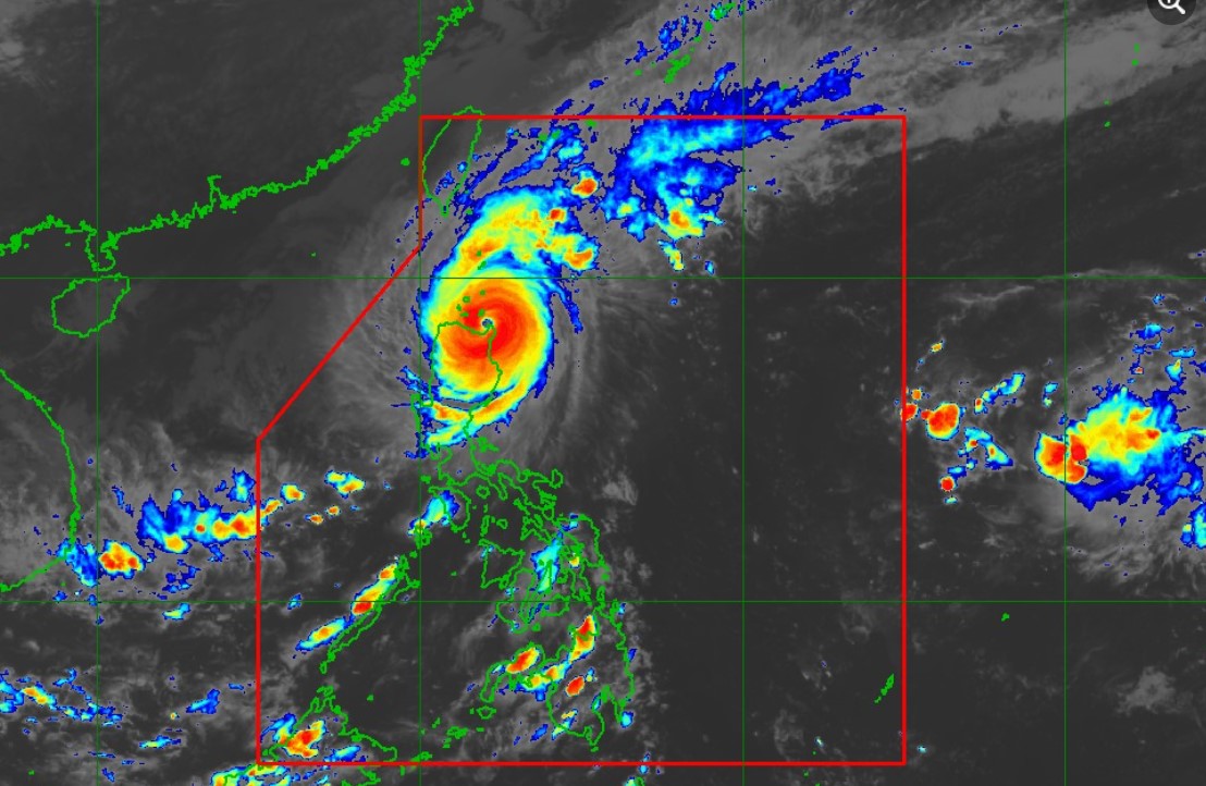
PAGASA warns of life-threatening conditions in north Luzon

PAGASA warned of life-threatening conditions in the northern portions of Luzon after Typhoon Marce made landfall in Sta. Ana, Cagayan on Thursday afternoon.
“Regardless of the position of the center of the eye in the next several hours, it must be emphasized that potentially life-threatening conditions due to typhoon-force winds, storm surge inundation, and torrential rainfall will be experienced in the Babuyan Islands and the northern portions of mainland Cagayan, Ilocos Norte, and Apayao,” said PAGASA in its 5 p.m. tropical cyclone bulletin.
Signal No. 4 remains hoisted over:
- the northern portion of Cagayan including Babuyan Islands,
- the northern portion of Apayao, and
- the northern portion of Ilocos Norte.
The following areas are under Signal No. 3:
- Batanes,
- the rest of Cagayan,
- the rest of Apayao,
- the rest of Ilocos Norte,
- the northern portion of Abra (Tineg, Danglas, Lagayan, Lacub, San Juan, La Paz, Bangued) and
- the northern portion of Ilocos Sur (Sinair, Cabugao, San Juan, Magsingal, Santo Domingo).
The following areas were also placed under Signal No. 2:
- the northern and central portions of Isabela (San Pablo, Santa Maria, Divilacan, Tumauini, Maconacon, Cabagan, Santo Tomas, Quezon, Palanan, Ilagan City, Mallig, Delfin Albano, Quirino, San Mariano, Gamu, Roxas, Naguilian, Burgos, Reina Mercedes, Benito Soliven, Luna, Aurora, San Manuel, San Mateo, Alicia, Angadanan, City of Cauayan, Cabatuan)
- the rest of Abra
- Kalinga
- Mountain Province
- the northern portion of Ifugao (Alfonso Lista, Aguinaldo, Mayoyao, Banaue, Hungduan)
- the northern portion of Benguet (Bakun, Mankayan)
- the rest of Ilocos Sur
- the northern portion of La Union (Sudipen, Bangar, Balaoan, Luna, Santol).
Further, Signal No. 1 is in effect in the following areas:
- the rest of La Union
- Pangasinan
- the rest of Ifugao
- the rest of Benguet
- the rest of Isabela
- Quirino
- Nueva Vizcaya
- the northern and central portions of Aurora (Dilasag, Casiguran, Dinalungan, Dipaculao, Maria Aurora, Baler)
- the northern portion of Nueva Ecija (Carranglan)
- the northern portion of Zambales (Santa Cruz, Candelaria).
Marce has maximum sustained winds of 175 kph near the center and gustiness of up to 240 kph. It moves westward at 10 kph, PAGASA added.
After making a landfall in Santa Ana, Cagayan at 3:40 p.m., Marce will move generally westward, briefly emerge over Aparri Bay, and make another landfall along the coast of northwestern mainland Cagayan tonight.
The typhoon is expected to exit the Philippine Area of Responsibility on Friday afternoon or evening.
But PAGASA has yet to rule out the possibility of Marce developing into a super typhoon. —NB, GMA Integrated News


