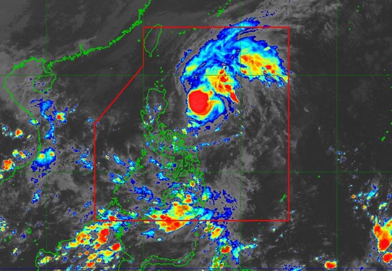
Marce slightly intensifies over Philippine Sea, Signal No. 1 raised over 14 areas

Typhoon Marce slightly intensified over the Philippine Sea east of Isabela as Signal No. 1 is raised over 14 areas, according to the latest Tropical Cyclone Bulletin posted by PAGASA Tuesday afternoon.
PAGASA said the center of the eye of Typhoon Marce was estimated at 480 kilometers east of Echague, Isabela, packing maximum sustained winds of 130 kilometers per hour near the center and gustiness of up to 160 kph.
According to PAGASA's 5 p.m. Tropical Cyclone Bulletin, Marce is moving northwestward at the speed of 25 kph over Isabela. The weather bureau said MARCE is expected to make landfall or pass close to Babuyan Islands or the northern portion of mainland Cagayan on Thursday afternoon or evening.
Areas under Signal No. 1 will experience winds of 39 to 61 kph or intermittent rains over the next 36 hours:
- Batanes
- Cagayan including Babuyan Islands
- Ilocos Norte
- Ilocos Sur
- Apayao
- Abra
- Kalinga
- Mountain Province
- Ifugao
- the northern portion of Benguet (Mankayan, Buguias, Kabayan, Bakun, Kibungan, Atok, Bokod)
- Isabela
- Nueva Vizcaya
- Quirino
- the northern portion of Aurora (Dilasag, Casiguran, Dinalungan, Dipaculao, Baler, Maria Aurora)
PAGASA reported that the northeasterly wind flow will also bring strong to gale-force gusts over the following areas (especially in coastal and upland areas exposed to winds): Ilocos Sur, Aurora, Quezon, and Camarines Norte.
A Gale Warning is hoisted over the northern and eastern seaboards of Northern Luzon.
PAGASA also warned of the possibility of raising tropical wind cyclone signals to level 4 within the forecast period.
It is predicted to exit the Philippine Area of Responsibility by Friday afternoon or evening. — Jiselle Anne Casucian/BAP/RSJ, GMA Integrated News


