PAGASA: Marce stronger, Signal No. 1 over parts of north Luzon

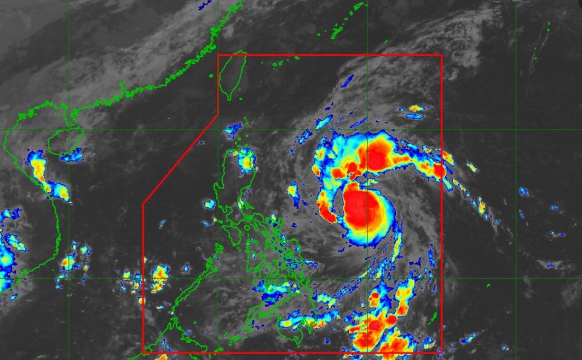
Marce has intensified into a severe tropical storm and seven areas in Luzon have been placed under Signal No. 1.
According to its 11 p.m. tropical cyclone bulletin, PAGASA said Signal No. 1 was hoisted over the following areas:
- Batanes
- the northern and eastern portions of Cagayan (Camalaniugan, Lal-Lo, Pamplona, Gonzaga, Santa Teresita, Baggao, Buguey, Santa Ana, Claveria, Gattaran, Peñablanca, Lasam, Aparri, Ballesteros, Abulug, Allacapan, Sanchez-Mira, Santa Praxedes, Alcala, Amulung, Iguig) including Babuyan Islands
- the eastern portion of Isabela (Maconacon, San Pablo, Divilacan, Palanan, Dinapigue)
- the northern portion of Apayao (Santa Marcela, Luna, Calanasan, Flora, Pudtol)
- the northern portion of Apayao (Santa Marcela, Luna, Calanasan, Flora, Pudtol)
- the northern portion of Ilocos Norte (Isabela (Maconacon, San Pablo, Divilacan, Palanan, Dinapigue)
- Apayao (Santa Marcela, Luna, Calanasan, Flora, Pudtol)
PAGASA warned of winds from 39 to 61 kph.
It said the highest wind signal which may be hoisted during the occurrence of Marce is Signal No. 4.
At 10 p.m., Marce was monitored 590 km east of Virac, Catanduanes or 715 km east of Daet, Camarines Norte with maximum sustained winds of 100 kph and gustiness of 125 kph, and moving northwestward at 35 kph.
The northeasterly wind flow will bring strong to gale-force gusts over the coastal and upland areas of Ilocos Sur, Aurora, Quezon, and Camarines Norte on Tuesday.
“A Gale Warning will likely be hoisted over the seaboard of Northern Luzon tomorrow,” PAGASA said.
Marce is also expected to move generally west-northwestward on Monday until Wednesday morning before decelerating and turning westward over the Philippine Sea east of extreme Northern Luzon.
PAGASA said Marce may make landfall in the vicinity of Babuyan Islands or mainland northern Cagayan on Thursday evening (7 November) or Friday (8 November) early morning.
“Due to uncertainty in the strength of the high-pressure area north of Marce, the forecast track may still change and bring the landfall point to mainland Cagayan-Isabela area,” PAGASA said.
“Marce is currently undergoing rapid intensification. This tropical cyclone is expected to continue to rapidly intensify and may reach typhoon category Tuesday (5 November) morning,” it added.


