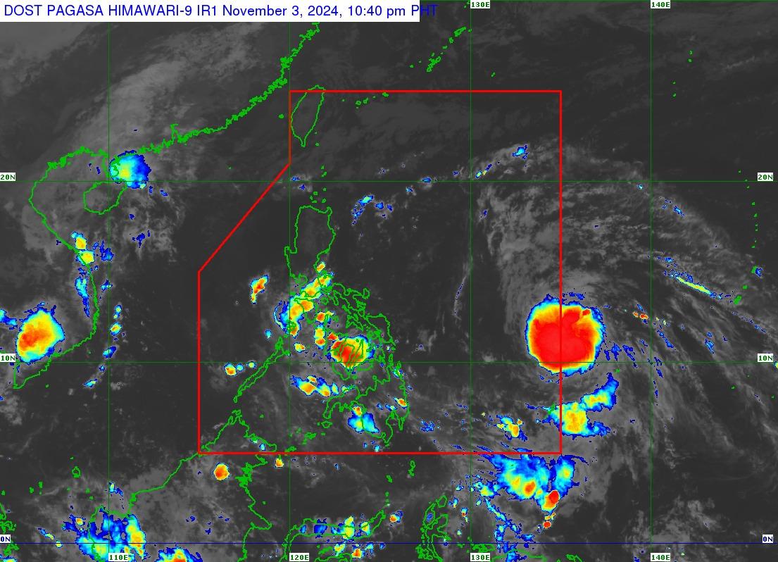
Tropical depression outside PAR keeps strength, moves northwest

The tropical depression that had developed from a low-pressure area outside the Philippine Area of Responsibility (PAR) has maintained its strength while it moves northwest, PAGASA said late Sunday evening.
At 10 p.m., the tropical depression was observed, still outside PAR, 1,130 kms east of Eastern Visayas, with maximum sustained winds of 55 kph and gustiness of up to 70 kph, and moving northwestward at 45 kph.
In its 11 p.m. weather advisory, PAGASA said the tropical depression will keep moving northwestward “at a fast pace” and may enter PAR early Monday morning.
The tropical depression will be called “Marce” should it enter PAR.
As it moves northwestward with PAR, the tropical depression may enhance the surge of northeasterly wind flow which may occur within the week.
“This, and the trough of the tropical cyclone, will bring rains over Extreme Northern Luzon and the eastern section of Luzon beginning tomorrow or on Tuesday,” PAGASA said.
It added that the tropical depression is seen to worsen sea conditions over the seaboards of Northern Luzon and the western and eastern seaboards of Central and Southern Luzon.
“The hoisting of Gale Warning over the seaboards of northern Luzon may begin on Tuesday,” PAGASA said.
The storm will continue to move northwestward until Tuesday before it begins to slow down significantly while turning westward, according to PAGASA.
The storm will then either move further westward towards extreme Northern Luzon or mainland Luzon or will move erratically over the Philippine Sea east of Extreme Northern Luzon.
“This portion of the track forecast is highly likely to change in the succeeding advisories or bulletins,” state meteorologists said.
PAGASA earlier said the country may see one to two tropical cyclones in November. — Mariel Celine Serquiña/BM, GMA Integrated News


