Tropical Storm Kong-Rey enters PAR, now called Leon

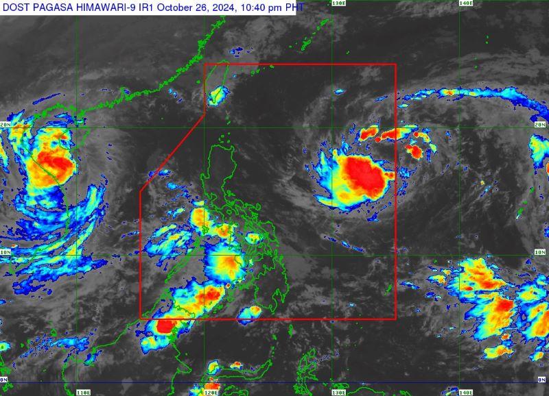
Tropical Storm Kong-Rey entered the Philippine Area of Responsibility on Saturday evening, the state weather bureau PAGASA said.
The agency said Kong-Rey, which was given the local name ''Leon,'' moved inside the PAR at 7:30 p.m.
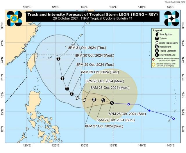
At 10 p.m., Leon was located 1,355 kilometers east of Central Luzon, with maximum sustained winds of 65 km/h and gustiness of up to 80 km/h.
It was moving westward at 25 km/h.

In its 11 p.m. bulletin, PAGASA said Leon is “unlikely” to directly affect the county's weather conditions but ''depending on how close it will be during its recurvature over the Philippine Sea, the outer rainbands of Leon may also affect Extreme Northern Luzon.''
''It may also continue to influence the Southwesterly Windflow initially triggered by Severe Tropical Storm Kristine, which may affect the western section of Southern Luzon, Visayas, and Mindanao in the coming days,'' PAGASA said.
The weather bureau may hoist Signal No. 1 over portions of Cagayan Valley and the northeastern portion of the Bicol Region by Sunday afternoon or evening.
''The highest Wind Signal [that] may be hoisted during the occurrence of Leon is Wind Signal No. 2,'' PAGASA said.
PAGASA said strong to gale-force gusts will occur over Catanduanes, Northern Samar, Eastern Samar, and Dinagat Islands on Sunday.
State meteorologists said Leon may bring moderate to rough sea conditions over the northern and eastern seaboards of Luzon and the eastern seaboard of Visayas.
“This tropical cyclone is forecast to remain far from the Philippine landmass. However, the track forecast may still shift with the limit of the forecast confidence cone,” PAGASA said.
Leon, the 12th tropical cyclone to enter the PAR this year, is expected to intensify into a severe tropical storm on Sunday evening or early Monday morning.
It may reach the typhoon category on Monday evening or early Tuesday morning. —Mariel Celine Serquiña/VBL, GMA Integrated News


