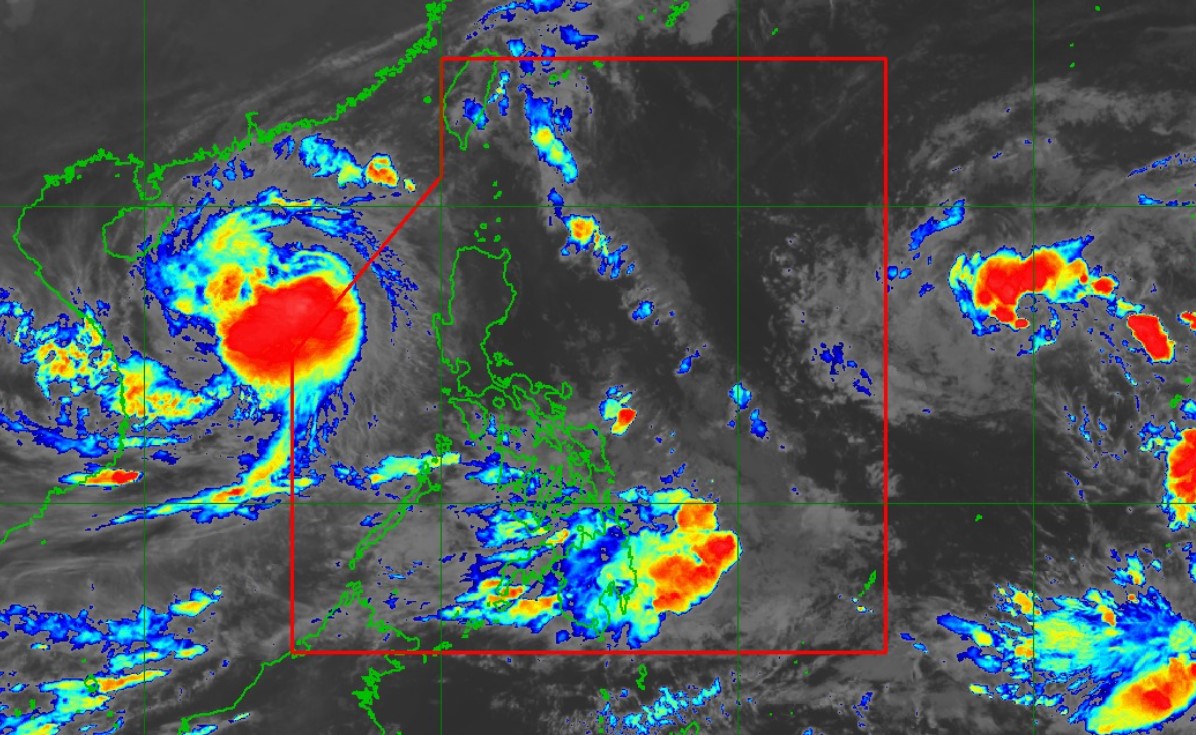
PAGASA: Storm seen to enter PAR on Saturday night or Sunday morning

Kong-Rey, the tropical storm east of the Philippine Area of Responsibility, is expected to enter the PAR on Saturday night or early Sunday morning, PAGASA said on Friday night.
According to its advisory on Kong-Rey, the storm is also expected to gradually intensify. It may reach a severe tropical storm category on Sunday and become a typhoon on Monday.
Kong-Rey will be called Leon domestically when it enters the PAR.
This developed as PAGASA lifted all tropical cyclone signals related to Severe Tropical Storm Kristine after it left the PAR at 2 p.m. on Friday.
However, Kristine which has been moving westward over the West Philippine Sea is expected to make a U-turn and loop counterclockwise on Sunday and Monday before moving eastward towards the archipelago.
“However, this scenario heavily depends on the behavior of tropical cyclone Kong-rey over east of the PAR region and the behavior of other synoptic weather systems surrounding Kristine while over the West Philippine Sea,'' PAGASA said.
Meteorologists refer to the interaction of two tropical cyclones as the Fujiwhara effect.
According to the US National Weather Service, when two tropical cyclones "spinning in the same direction pass close enough to each other, they begin an intense dance around their common center."
At 11 p.m. on Friday, Kong-Rey was spotted 1,980 kilometers east of Central Luzon or 1,780 km east of southeastern Luzon outside the PAR.
It has maximum sustained winds of 65 kilometers per hour near the center, and gustiness of up to 80 kph, said PAGASA. Kong-rey is presently moving west-northwestward at 25 kph.
Meanwhile, at 11 p.m., Kristine was located 535 kilometers west of Bacnotan, La Union as it moved west-southwestward at 25 kph.
It has maximum sustained winds of 95 kph near the center and gustiness of up to 115 kph.
"Depending on how close it will be during its recurvature over the Philippine Sea, the outer rainbands of Kong-Rey may also affect extreme Northern Luzon," PAGASA said.
"Furthermore, it may continue to influence the Southwesterly Windflow initially triggered by Severe Tropical Storm Kristine, which may affect the western section of Southern Luzon, Visayas, and Mindanao in the coming days," it added.
Kong-Rey may bring moderate to rough sea conditions over the northern and eastern seaboards of Luzon and the eastern seaboard of Visayas, PAGASA said.
PAGASA weather forecaster Chenel Dominguez said in a press briefing on Friday that moderate to heavy rains, or 50 to 100 mm of rain, will be felt in the following areas on Saturday:
- Palawan
- Western Visayas
- Negros Occidental
- the southern portion of Negros Oriental
- Zamboanga Peninsula
Further, PAGASA said that Kristine will still bring strong to gale-force gusts over the following:
Saturday (October 26)
- Palawan
- Romblon
- Western Visayas
- Negros Island Region
- Siquijor
- Bohol
- Southern Leyte
- Zamboanga del Norte
- Camiguin
- Dinagat Islands
- Surigao del Norte
Sunday (October 27)
- Palawan
- Romblon
- Visayas
- Zamboanga del Norte
- Camiguin
- Dinagat Islands
- Surigao del Norte
—NB/VBL, GMA Integrated News


