

PAGASA: Tropical depression outside PAR now a storm
The tropical depression monitored outside the Philippine Area of Responsibility has developed into a tropical storm on Friday afternoon, state weather bureau PAGASA said.
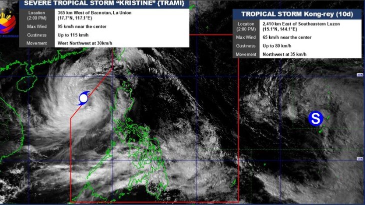
As of 4 p.m., Tropical Storm Kong-rey was spotted 2,355 kilometers east of southeastern Luzon.
It has winds of up to 65 kph near the center and gustiness of up to 80 kph.
State meteorologists added that the tropical storm was moving northwest at 35 kph.
Once it enters the PAR, the tropical storm will be named "Leon" and will be the 12th tropical cyclone to enter the country.
“The tropical cyclone will then turn northwestward on Tuesday (29 October), then generally northward on Wednesday (30 October) over the Philippine Sea. Within the PAR region, the path of Kong-rey will remain far from the Philippine landmass,” the state weather bureau said in its latest advisory.
Further, PAGASA said that the tropical storm is expected to gradually intensify and may progress into a severe tropical storm category also on Sunday. It may also reach the typhoon category on Monday, the state weather bureau added.
PAGASA also said that the tropical cyclone may continue to influence the southwesterly wind flow initially triggered by Severe Tropical Storm Kristine, affecting the western portion of southern Luzon, Visayas, and Mindanao in the coming days. — Vince Angelo Ferreras/NB/VBL, GMA Integrated News
