

Kristine keeps strength over sea east of Aurora
Thirty-one areas remain under Signal No. 2 as Tropical Storm Kristine (international name: Trami) maintains its strength over the sea east of Aurora.
According to PAGASA’s 2 p.m. tropical cyclone bulletin on Wednesday, the following areas under Signal No. 2 may expect winds of greater than 62 km/h up to 88 km/h within 24 hours:
· Ilocos Norte
· Ilocos Sur
· La Union
· Pangasinan
· Apayao
· Abra
· Kalinga
· Mountain Province
· Ifugao
· Benguet
· Cagayan including Babuyan Islands
· Isabela
· Quirino
· Nueva Vizcaya
· Aurora
· Nueva Ecija
· Bulacan
· Tarlac
· Pampanga
· Zambales
· Bataan
· Metro Manila
· Cavite
· Laguna
· Rizal
· Quezon including Polillo Islands
· Camarines Norte
· Camarines Sur
· Catanduanes
· Albay
· The northeastern portion of Sorsogon (Prieto Diaz, City of Sorsogon)
The following areas under Signal No. 1 may expect winds of 39 km/h to 61 km/h or intermittent rains within 36 hours:
- Batanes
- Batangas
- Occidental Mindoro including Lubang Islands
- Oriental Mindoro
- Marinduque
- Romblon
- Calamian Islands
- the rest of Sorsogon
- Masbate including Ticao and Burias Islands
- Aklan
- Capiz
- Antique including Caluya Islands
- Iloilo
- Guimaras
- the northern portion of Negros Occidental (Pontevedra, La Castellana, Moises Padilla, Bago City, La Carlota City, Valladolid, Pulupandan, Bacolod City, San Enrique, Murcia, Silay City, City of Talisay, Enrique B. Magalona, Manapla, City of Victorias, Cadiz City, Sagay City, City of Escalante, Toboso, Calatrava, Salvador Benedicto, San Carlos City)
- the northern portion of Negros Oriental (Vallehermoso, Canlaon City, City of Guihulngan)
- the northern and central portions of Cebu (Alcantara, Argao, Dumanjug, Sibonga, Pinamungahan, Ronda, Liloan, Cebu City, Moalboal, Consolacion, Danao City, Borbon, Carmen, Daanbantayan, Tuburan, City of Bogo, Tabogon, City of Naga, Lapu-Lapu City, City of Carcar, Mandaue City, Catmon, Minglanilla, Toledo City, Cordova, Compostela, San Remigio, Balamban, Aloguinsan, San Fernando, Asturias, Barili, Medellin, Sogod, Tabuelan, City of Talisay) including Bantayan Islands and Camotes Islands
- Bohol
- Eastern Samar
- Northern Samar
- Samar
- Leyte
- Biliran
- Southern Leyte
- Dinagat Islands
- Surigao del Norte including Siargao - Bucas Grande Group
PAGASA warned of the possibility of raising Signal No. 3 in some areas.
In a weather advisory issued at 2 p.m., the following areas may anticipate heavy rainfall over the next few days:
Wednesday
· Intense to Torrential (>200 mm): Cagayan, Isabela, Apayao, Aurora, Quezon, and Camarines Norte
· Heavy to Intense (100 to 200 mm): Camarines Sur, the rest of Cagayan Valley, the rest of Cordillera Administrative Region, Ilocos Region, Rizal
· Moderate to Heavy (50 to 100 mm): The rest of Central Luzon, the rest of CALABARZON, Metro Manila, Occidental Mindoro, Oriental Mindoro, Marinduque, Romblon, Calamian Islands, Catanduanes, Albay, Sorsogon, Masbate, and Northern Samar
Thursday
· Intense to Torrential (>200 mm): Pangasinan, Zambales, and La Union
· Heavy to Intense (100 to 200 mm): The rest of Ilocos Region, Cordillera Administrative Region, and Bataan
· Moderate to Heavy (50 to 100 mm): Tarlac, Pampanga, Nueva Ecija, Bulacan, Metro Manila, Cavite, Batangas, and Occidental Mindoro
Friday
· Moderate to Heavy (50 to 100 mm): Pangasinan, Zambales, and La Union
The Northeasterly Windflow will also enhance winds from the typhoon, and cause strong to gale-force gusts over the following areas:
Wednesday: MIMAROPA, Visayas, and Mindanao
Thursday: MIMAROPA, Bicol Region, Visayas, Basilan, Sulu, Tawi-Tawi, Zamboanga del Norte, Lanao del Sur, Northern Mindanao, Dinagat Islands, Surigao del Norte, Davao del Sur, and Davao Oriental
Friday: MIMAROPA, Bicol Region, Western Visayas, Negros Occidental, Zamboanga del Norte, Basilan, Sulu, and Tawi-Tawi
Meanwhile, a gale warning has been raised over the seaboards of Luzon and Visayas.
PAGASA warned of moderate to significant risk of life-threatening storm surge in the next 48 hours over the low-lying or exposed coastal localities of Ilocos Norte, Ilocos Sur, La Union, Pangasinan, Cagayan, Isabela, Zambales, Aurora, Camarines Sur, and Catanduanes.
The following coastal waters may expect rough sea conditions within the next few days:
Up to high seas
the seaboard of Cagayan Valley, Ilocos Region, and Zambales
the seaboard of Aurora, Polillo Islands, Camarines Norte
the northern and eastern seaboard of Catanduanes
the northern seaboard of Camarines Sur
the western seaboard of Bataan
Up to very rough seas
· the western seaboard of Batangas
· the seaboard of Lubang Islands
· The western seaboard of Cavite, Occidental Mindoro, and Calamian Islands
· the eastern seaboard of Camarines Sur, Albay, Sorsogon
· the northern and eastern seaboard of Northern Samar
Up to rough seas
· the seaboard of Cuyo Islands
· the western seaboard of Western Visayas, Negros Occidental, and Negros Oriental
· the remaining seaboards of Luzon and Visayas
· the seaboard of Dinagat Islands, Camiguin, and Zamboanga del Norte
· the northern and western seaboard of Surigao del Norte.
Up to moderate seas
· the remaining seaboards of Mindanao.
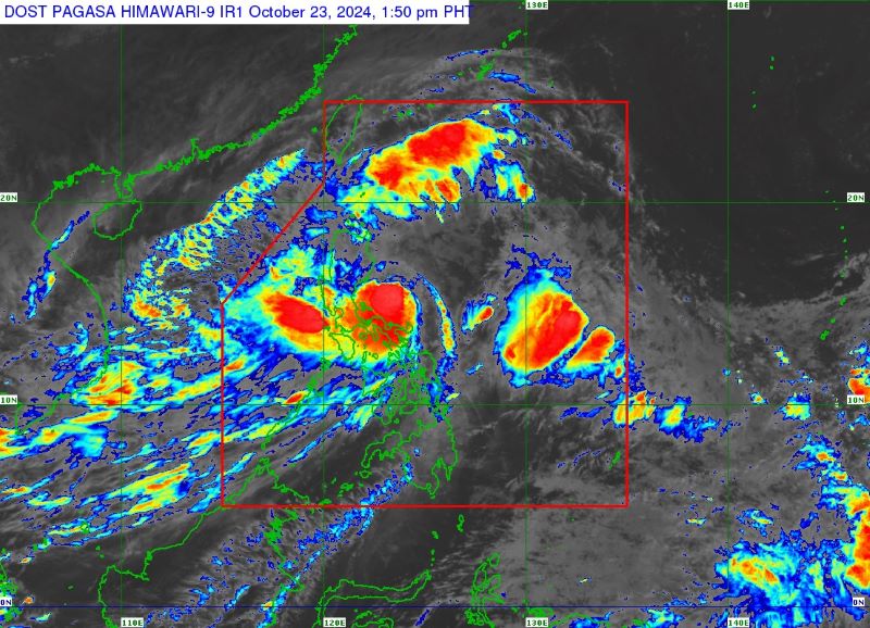
At 1 p.m. Kristine was seen 155 kilometers east of Casiguran, Aurora, with maximum sustained winds of 85 km/h and gustiness of up to 105 km/h, moving northwestward at 10 km/h.
Kristine is forecast to make landfall over Isabela on Wednesday night or early Thursday morning.
After this, Kristine is predicted to weaken slightly over Northern Luzon, but may re-intensify over the West Philippine Sea.
The tropical cyclone is expected to exit the Philippine Area of Responsibility on Friday.
3 dead
Three people were reported dead in Bicol Region due to Kristine's effects, according to the Police Regional Office 5 (PRO5) on Wednesday.
In its 8 a.m. report, the NDRRMC also said one person was reported injured in the region.
A total of 382,302 individuals or 77,910 families have been affected by Kristine in Bicol, Western Visayas, Eastern Visayas, and Zamboanga Peninsula.
Of the affected population, 12,334 people or 3,095 families were staying in evacuation centers while 364 people or 96 families were taking shelter in other places.
The NDRRMC said floods, landslides, a vehicular accident, and an uprooted tree were reported in the affected regions.
Fifty-seven houses were damaged, 49 partially and eight totally. One structure was also damaged.
Power outages were experienced in 36 areas and communication line issues were reported in one area.
Operations in 34 seaports in CALABARZON, MIMAROPA, Bicol, Central Visayas, and Eastern Visayas were suspended due to Kristine. As a result, a total of 4,753 passengers, 703 rolling cargoes, 26 vessels, and 13 motorized bancas were stranded.
Classes in 602 areas and work schedules in 164 areas have been suspended due to the threat of Kristine, according to the NDRRMC report. — Jiselle Anne Casucian/VBL, GMA Integrated News
