

7 areas under Signal No. 2 as Kristine slightly intensifies
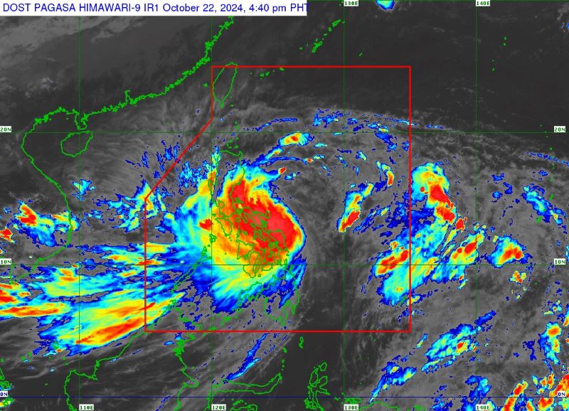
Tropical Storm Kristine (international name: Trami) picked up strength while over the Philippine Sea, the state weather bureau PAGASA said on Tuesday afternoon.
In its 5 p.m. bulletin, PAGASA said Kristine has maximum sustained winds of 75 km/h and gustiness of up to 90 km/h.
Last spotted 390 km east of Daet, Camarines Norte, Kristine was moving west northwestward at 15 km/h.
Signal No. 2 was hoisted over the following areas:
- Catanduanes
- the eastern portion of Camarines Norte (Basud, Daet, Talisay, Vinzons, Paracale, Mercedes)
- the eastern portion of Camarines Sur (Caramoan, Presentacion, Garchitorena, Tinambac, Siruma, Lagonoy, Goa, San Jose, Saglay, Tigaon)
- the eastern portion of Albay (Rapu-Rapu, Bacacay, City of Tabaco, Malilipot, Malinao, Tiwi)
- the eastern portion of Sorsogon (Barcelona, Gubat, Prieto Diaz)
- the northeastern portion of Northern Samar (Palapag, Mapanas, Gamay, Laoang, Catubig, Lapinig, Pambujan, San Roque)
- the northern portion of Eastern Samar (Jipapad, San Policarpo, Arteche)
Under Signal No. 1 are the following:
- Ilocos Norte
- Ilocos Sur
- La Union
- Pangasinan
- Apayao
- Kalinga
- Abra
- Mountain Province
- Ifugao
- Benguet
- Cagayan, including Babuyan Islands
- Isabela
- Quirino
- Nueva Vizcaya
- Aurora
- Nueva Ecija
- Tarlac
- Zambales
- Bataan
- Pampanga
- Bulacan
- Metro Manila
- Cavite
- Laguna
- Batangas
- Rizal
- Quezon, including Pollilo Islands
- Occidental Mindoro, including Lubang Islands
- Oriental Mindoro
- Masbate, including Ticao and Burias Islands
- Marinduque
- Romblon
- the rest of Camarines Norte
- the rest of Camarines Sur
- the rest of Albay
- the rest of Sorsogon
- the rest of Eastern Samar
- the rest of Northern Samar
- Samar
- Leyte
- Biliran
- Southern Leyte
- Dinagat Islands
- Surigao del Norte, including Siargao - Bucas Grande Group
''The highest Wind Signal [that] may be hoisted during the occurrence of Kristine is Wind Signal No. 3,'' it said.
According to PAGASA, Kristine will bring heavy rainfall over these areas:
Tuesday to Wednesday afternoon
·Intense to Torrential (>200 mm): Catanduanes, Camarines Norte, Camarines Sur, Albay, Sorsogon, and Northern Samar
·Heavy to Intense (100 to 200 mm): Masbate, Samar, Eastern Samar, Isabela, and Quezon
·Moderate to Heavy (50 to 100 mm): The rest of Cagayan Valley, Cordillera Administrative Region, Aurora, Nueva Ecija, Romblon, Marinduque, and the rest of Visayas
Wednesday afternoon to Thursday afternoon
·Intense to Torrential (>200 mm): Isabela, Cagayan, Apayao, and Ilocos Norte
·Heavy to Intense (100 to 200 mm): The rest of Cordillera Administrative Region, the rest of Cagayan Valley, the rest of Ilocos Region, and Central Luzon
·Moderate to Heavy (50 to 100 mm): CALABARZON, Metro Manila, Occidental Mindoro, Camarines Norte, and Camarines Sur
Thursday afternoon to Friday afternoon
·Heavy to Intense (100 to 200 mm): Ilocos Region, Cordillera Administrative Region, Zambales, and Bataan
·Moderate to Heavy (50 to 100 mm): The rest of Central Luzon, Cavite, Laguna, Rizal, Metro Manila, and Occidental Mindoro
Strong to gale-force gusts may be expected in the following areas:
Tuesday: Batanes, Babuyan Islands, Ilocos Region, Palawan, Romblon, Western Visayas, Negros Island Region, Central Visayas, Southern Leyte, Zamboanga del Norte, Northern Mindanao, Dinagat Islands, Surigao del Norte, Agusan del Norte, Sarangani, Davao del Sur, and Davao Oriental
Wednesday: MIMAROPA, Visayas, and Mindanao
Thursday: MIMAROPA, Bicol Region, Visayas, Basilan, Sulu, Tawi-Tawi, Zamboanga del Norte, Lanao del Sur, Northern Mindanao, Dinagat Islands, Surigao del Norte, Davao del Sur, and Davao Oriental
''There is a minimal to moderate risk of life-threatening storm surge in the next 48 hours over the low-lying or exposed coastal localities of Catanduanes, Camarines Norte, Camarines Sur, Albay, Quezon, Aurora, Isabela, and Cagayan,'' PAGASA said.
Kristine is expected to make landfall over Isabela or northern Aurora on Wednesday evening or early Thursday morning.
''It will then cross the mountainous terrain of Northern Luzon and emerge over the waters west of Ilocos Region on Thursday afternoon or evening. Kristine may exit the Philippine Area of Responsibility (PAR) region on Friday,'' PAGASA said.
''Kristine is forecast to gradually intensify into a severe tropical storm before making landfall. Slight weakening will occur while crossing Northern Luzon. Re-intensification may occur over the West Philippine Sea.'' — Jiselle Anne Casucian/VBL, GMA Integrated News
