

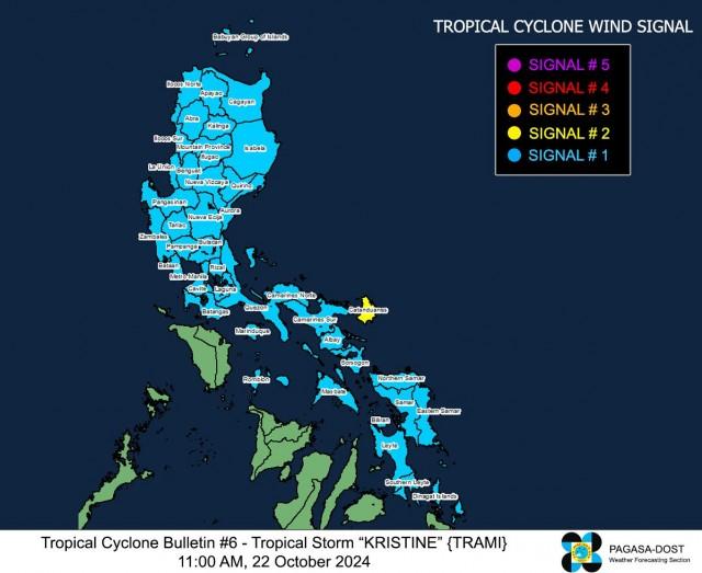
Signal No. 2 up over Catanduanes as TS Kristine maintains strength
Tropical Cyclone Wind Signal No. 2 was raised over Catanduanes on Tuesday as Tropical Storm Kristine maintained its strength, PAGASA said in its 11 a.m. bulletin.
Under TCWS No. 2, winds of greater than 62 km/h and up to 88 km/h may be expected in at least 24 hours.
Meanwhile, PAGASA said the following areas are under Signal No. 1:
Luzon
Ilocos Norte
Ilocos Sur
La Union
Pangasinan
Apayao
Kalinga
Abra
Mountain Province
Ifugao
Benguet
Cagayan including Babuyan Islands
Isabela
Quirino
Nueva Vizcaya
Aurora
Nueva Ecija
Tarlac
Zambales
Bataan
Pampanga
Bulacan
Metro Manila
Cavite
Laguna
Batangas
Rizal
Quezon including Pollilo Islands
Masbate including Ticao Island
Burias Island
Marinduque
Romblon
and
Camarines Norte
Camarines Sur
Albay
Sorsogon
Visayas
Eastern Samar
Northern Samar
Samar
Leyte
Biliran
and Southern Leyte
Mindanao
Dinagat Islands and Surigao del Norte including Siargao - Bucas Grande Group
Under Signal No. 1, winds of 39-61 km/h may be expected in at least 36 hours or intermittent rains may be expected within 36 hours.
PAGASA said the highest wind signal that may be hoisted during the occurrence of TS Kristine is still TCWS No. 3, considering the possibility of rapid intensification.
Meanwhile, the wind flow coming towards the circulation of the tropical cyclone and the northeasterly windflow will also bring strong gale-force gusts over the following areas (especially in coastal and upland areas exposed to winds):
Batanes, Babuyan Islands, Ilocos Region, Palawan, Romblon, Aklan, Antique, Negros Island Region, Central Visayas, Southern Leyte, Zamboanga del Norte, Northern Mindanao, Dinagat Islands, Surigao del Norte, Agusan del Norte, Sarangani, Davao del Sur, and Davao Oriental.
PAGASA also said that there is a moderate to high risk of life-threatening storm surge in the next 48 hours over the low-lying or exposed coastal localities of Catanduanes, Camarines Sur, Albay, Aurora, Isabela, and Cagayan.
Meanwhile, heavy rainfall is expected in the following areas from Tuesday up to Wednesday noon.
- Intense to torrential (>200 mm): Catanduanes, Camarines Norte, Camarines Sur, Albay, Sorsogon, and Northern Samar
- Heavy to intense (100 – 200 mm): Masbate, Samar, Eastern Samar, Isabela, and Quezon
- Moderate to heavy (50 – 100 mm): The rest of Cagayan Valley, Cordillera Administrative Region, Aurora, Nueva Ecija, Romblon, Marinduque, and the rest of Visayas
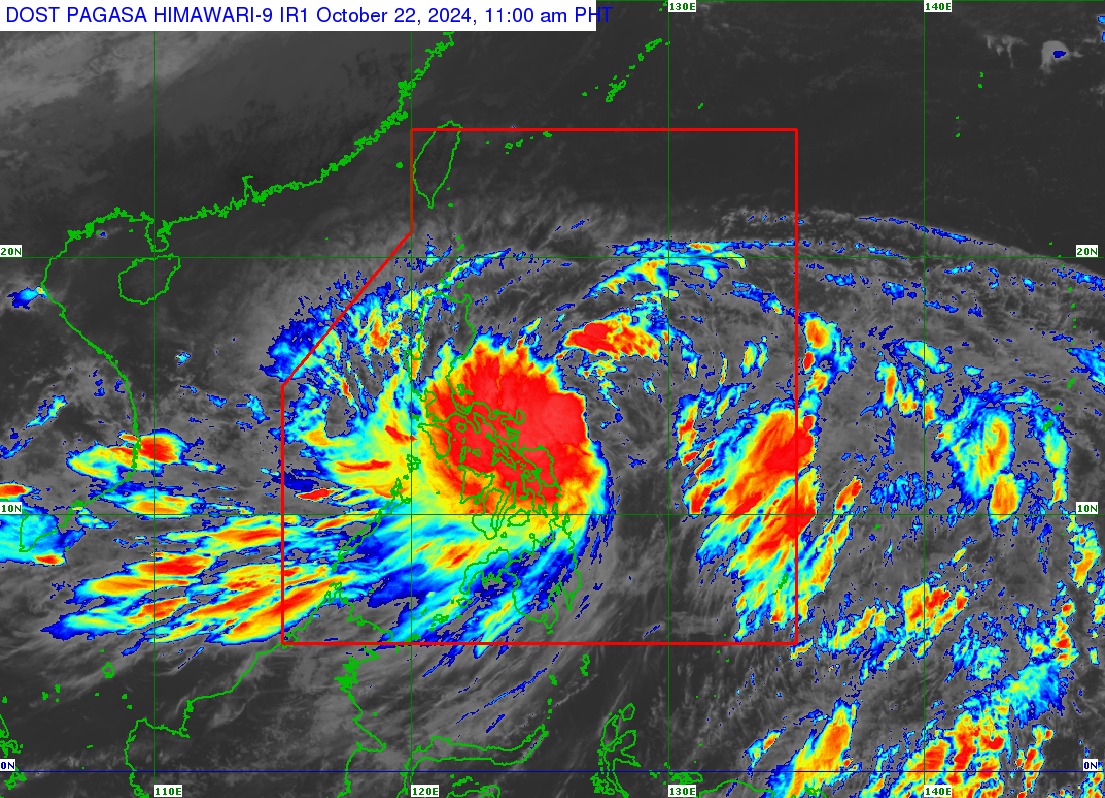
The center of the eye of Kristine (international name: Trami) was estimated at 10 a.m. based on all available data at 335 km east of Virac, Catanduanes (13.7 °N, 127.3 °E ).
Moving west northwestward at 10 kph, TS Kristine has maximum sustained winds of 65 km/h near the center and gustiness of up to 80 km/h.
Interior Secretary Juanito Victor “Jonvic” Remulla III on Tuesday ensured that all government units are prepared in anticipation of the effects of Tropical Storm Kristine.
“All units have been mobilized, all local government units have been informed. The final path is not yet determined – there’s one path that goes up north, this one path it goes to Central Luzon,” Remulla said at a Palace press briefing.
“So, we will know later tonight on which exact path it will follow,” he added.
Some areas suspended classes for Wednesday, October 23, 2024, or advised a shift to online classes or modular distance learning to ensure the safety of students. —Jamil Santos/ VAL/KG, GMA Integrated News
