PAGASA: Kristine seen a typhoon before landfall up north

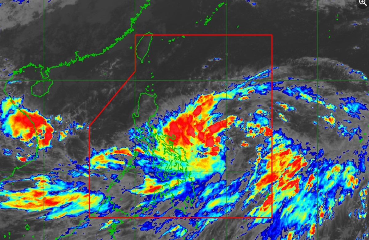
Tropical Depression Kristine may become a typhoon before it makes landfall, state weather bureau PAGASA said Monday late afternoon.
In its 5 p.m. bulletin, PAGASA said Kristine may intensify into a tropical storm in the next 12 hours.
State meteorologists added that Kristine is expected to hit land over Northern Luzon on Thursday evening or Friday morning.
Signal No. 1 is hoisted over 17 areas as the tropical depression slightly decelerated the following areas:
Luzon
- The southeastern portion of Isabela (Palanan, Dinapigue)
- Aurora
- The northern and eastern portions of Quezon (Tagkawayan, Guinayangan, Buenavista, San Narciso, San Andres, General Nakar, Pitogo, San Francisco, Calauag, Pagbilao, Infanta, Lopez, Catanauan, Mulanay, Unisan, General Luna, Plaridel, Quezon, Alabat, Sampaloc, Padre Burgos, Macalelon, Mauban, Perez, Agdangan, Gumaca, Atimonan, Real) including Pollilo Islands
- Camarines Norte
- Camarines Sur
- Catanduanes
- Albay
- Sorsogon
- Masbate including Ticao Island and Burias Island
Visayas
- Eastern Samar
- Northern Samar
- Samar
- Leyte
- Biliran
- Southern Leyte
Mindanao
- Dinagat Islands and
- Surigao del Norte including Siargao - Bucas Grande Group
“The highest TCWS that may be hoisted during the occurrence of KRISTINE is Wind Signal No. 4,” PAGASA said.
Kristine was located 870 kilometers east of Eastern Visayas packing maximum sustained winds of 55 km per hour near the center and gustiness of up to 70 kph, and moving westward at 15 kph.
Kristine will also bring strong to gale-force gusts over Batanes, Babuyan Islands, Ilocos Norte, Ilocos Sur, Palawan, Romblon, Aklan, Antique, Negros Island Region, the northern portion of Cebu, Bohol, Southern Leyte, Zamboanga del Norte, Northern Mindanao, Dinagat Islands, Surigao del Norte, Agusan del Norte, Sarangani, Davao del Sur, and Davao Oriental on Tuesday. —NB, GMA Integrated News


