

Storm signal lifted as Julian hits southern Taiwan
Typhoon Julian has made landfall over southern Taiwan, according to PAGASA’s 5 p.m. bulletin on Thursday.
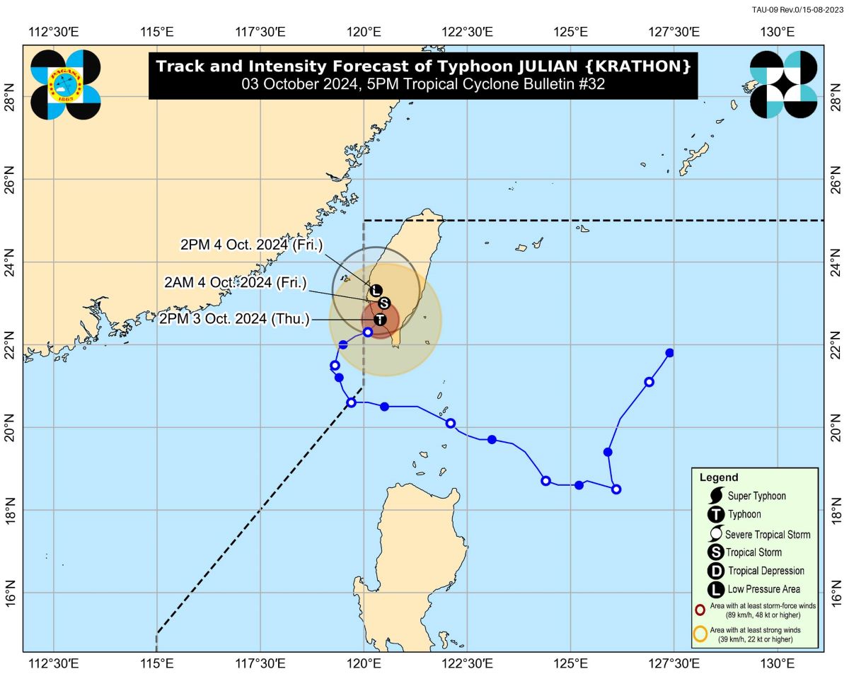
At 4 p.m., Julian was spotted 255 kilometers north northwest of Itbayat, Batanes.
The typhoon was moving east northeastward at 10 km/h, with winds of 120 km/h and gustiness of up to 200 km/h.
''This tropical cyclone is forecast to become a remnant low over Taiwan tomorrow (October 4),'' PAGASA said.
No tropical cyclone wind signals are in effect over any part of the Philippines.
However, moderate to rough seas may be expected over the following areas:
- Up to 4.0 m over the seaboards of Batanes, Babuyan Islands, and Ilocos Norte
- Up to 3.5 m over the remaining seaboards of the Ilocos Region
- Up to 3.0 m over the northern seaboard of Mainland Cagayan, Zambales, and Bataan
- Up to 2.5 m over the western seaboard of Lubang Island, the western seaboard of Calamian Islands, and the seaboard of Kalayaan Islands
Julian will still bring cloudy skies with scattered rains and thunderstorms over Batanes and the Babuyan Islands.
The typhoon's trough will also cause cloudy skies with scattered rains and thunderstorms in Ilocos Region, Apayao, Abra, Kalinga, and mainland Cagayan.
Central Luzon, the rest of the Cordillera Administrative Region, and the rest of Cagayan Valley will see partly cloudy to cloudy skies with isolated rain showers or thunderstorms caused by localized thunderstorms, while the rest of the country will experience partly cloudy to cloudy skies with isolated rain showers or thunderstorms due to the easterlies.
Meanwhile, Northern Luzon will experience moderate to strong winds with moderate to rough coastal waters.
The rest of the country will have light to moderate winds with slight to moderate coastal waters.
Sunrise in Metro Manila will be at 5:46 a.m. on Friday. — Jiselle Anne Casucian/VBL, GMA Integrated News
