

Signal No. 1 up over 4 areas as Julian maintains strength
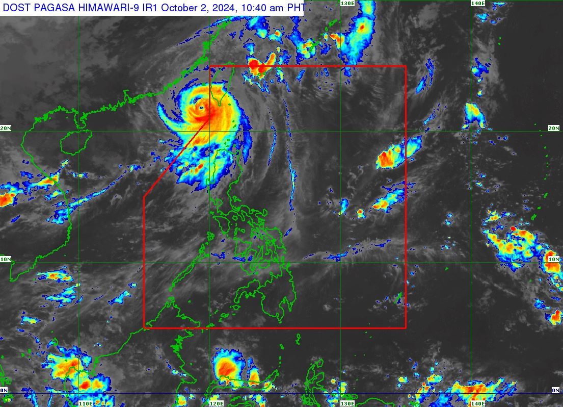
Signal No. 1 was raised over four areas in Luzon as Typhoon Julian, which is outside the Philippine Area of Responsibility (PAR), maintained its strength while moving north northeastward slowly, PAGASA reported Wednesday.
In its 11 a.m. bulletin, PAGASA said the following areas in Luzon were under Tropical Cyclone Wind Signal (TCWS) No. 1.
- Batanes
- Babuyan Islands
- the northern and western portions of Ilocos Norte (Pasuquin, Sarrat, Bangui, Vintar, Burgos, Pagudpud, Bacarra, Adams, San Nicolas, Dumalneg, Laoag City)
- the northwestern portion of mainland Cagayan (Santa Praxedes, Sanchez-Mira, Claveria)
Under Signal No. 1, winds of 39-61 km/h may be expected in at least 36 hours, or intermittent rains may be expected within 36 hours, PAGASA said.
At 10 a.m., the center of the eye of Julian was estimated 265 km west northwest of Itbayat, Batanes (outside PAR).
Moving north northeastward, it has maximum sustained winds of 165 km/h near the center and gustiness of up to 205 km/h.
Eight people were reported injured while one was missing after Julian brought heavy rains and strong winds in the northern part of Luzon, the National Disaster Risk Reduction and Management Council (NDRRMC) said Wednesday.
The NDRRMC said 43,093 families or 149,293 persons from Regions 1, 2 and Cordillera Administrative Region were affected by the tropical cyclone, of which 646 families or 2,176 persons were staying inside 58 evacuation centers and 921 families or 3,255 persons were staying in other places.
PAGASA said a gale warning was hoisted over the northern seaboard of Northern Luzon.
In the next 24 hours, very rough seas are expected over the following coastal waters:
- Up to 5.0 m over the seaboard of Batanes
- Up to 4.5 m over the seaboard of Babuyan Islands and the northern seaboard of Ilocos Norte
Moderate or rough seas over the following areas:
- Up to 4.0 m over the remaining seaboard of Ilocos Norte
- Up to 3.5 m over the remaining seaboards of Ilocos Region
- Up to 3.0 m over the northern seaboard of mainland Cagayan and the seaboard of Zambales
- Up to 2.5 m over the remaining seaboard of Cagayan and the seaboard of Isabela
PAGASA said sea travel is risky for most types or tonnage of vessels, including all small seacraft and motorbancas. Mariners were advised to remain in port or seek safe shelter or harbor.
Julian is expected to make landfall on the southwestern coast of Taiwan on Wednesday night or early Thursday morning.
''After landfall, Julian is forecast to move erratically over the landmass and coastal waters of Taiwan before emerging over the Taiwan Strait on Friday (October 4) evening or Saturday (October 5) early morning. Afterwards, the weather disturbance will move southwestward over the Taiwan Strait and the waters south of mainland China,'' PAGASA said.
Julian will also continue to weaken due to a combination of incoming northeasterly wind flow over the East China Sea and Taiwan Strait and lower ocean heat content in its vicinity, PAGASA said.
''Further weakening is expected once Julian hits the landmass over Taiwan due to frictional effects. The tropical cyclone may become a remnant low during the weekend,'' it said. —Jamil Santos/VBL, GMA Integrated News
