

Signal No. 4 over Batanes, northern part of Babuyan as Julian rapidly intensifies
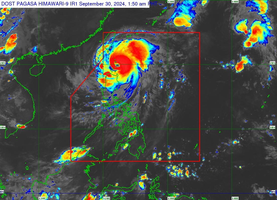
Typhoon Julian continues to "rapidly intensify" over the Balintang Channel between Batanes and the Babuyan Islands, PAGASA said early Monday, with Signal No. 4 hoisted over two areas in extreme northern Luzon.
According to the state weather bureau's 2 a.m. tropical cyclone bulletin, Signal No. 4 is over Batanes and the northern portion of Babuyan Islands (Babuyan Island and Calayan Island) as Julian (international name Krathon) moves west-northwest at 15 km/h with strong to typhoon-force winds extending outwards up to 560 km from the center.
Here are the areas where tropical cyclone wind signals have been hoisted:
Signal No. 4
- Batanes and
- the northern portion of Babuyan Islands (Babuyan Is., Calayan Is.)
Signal No. 3
- The rest of Babuyan Islands and
- the northeastern portion of mainland Cagayan (Santa Ana)
Signal No. 2
- The rest of mainland Cagayan,
- Apayao, and
- Ilocos Norte
Signal No. 1
- Ilocos Sur,
- La Union,
- Pangasinan,
- Abra,
- Kalinga,
- Ifugao,
- Mountain Province,
- Benguet,
- Isabela,
- Nueva Vizcaya,
- Quirino,
- Aurora,
- the northern and eastern portions of Nueva Ecija (Cuyapo, Rizal, Laur, Pantabangan, Science City of Muñoz, Gabaldon, Carranglan, San Jose City, Lupao, Talugtug, Bongabon, Llanera, Talavera, Palayan City, General Mamerto Natividad), and
- Polillo Islands
Heavy rainfall warnings
PAGASA also issued heavy rainfall warnings in the following areas:
Orange rainfall warning - Batanes, Babuyan Islands, Ilocos Norte, Ilocos Sur, Abra, Apayao and northern Cagayan(Abulug, Allacapan, Aparri, Ballesteros, Buguey, Calayan, Camalaniugan, Claveria, Gonzaga, Lal-lo, Pamplona, Sanchez Mira, Santa Ana, Santa Praxedes, Santa Teresita)
Yellow rainfall warning - La Union, Benguet, and the rest of Cagayan
Typhoon Julian may also bring strong to gale-force gusts over Pangasinan, Aurora, Zambales, Bataan, Metro Manila, CALABARZON, Romblon, and Bicol Region on Monday, particularly in coastal and upland areas exposed to winds.
Forecast track
Julian is forecast to move generally west-north over the Balintang and Bashi Channels and will either make landfall or "pass very close" to Batanes on Monday morning or afternoon, PAGASA said.
On Tuesday afternoon, Julian is expected to turn sharply northward toward Taiwan, where it may make landfall Tuesday evening or Wednesday morning.
It will continue intensifying over the next 48 hours and may become a super typhoon by the time it makes probable landfall over Taiwan. "In this case, Julian will pass near or over Batanes during its intensification period," PAGASA said.
The typhoon is forecast to exit the Philippine Area of Responsibility on Thursday. — BM, GMA Integrated News
