

Julian moves slowly over east of Cagayan
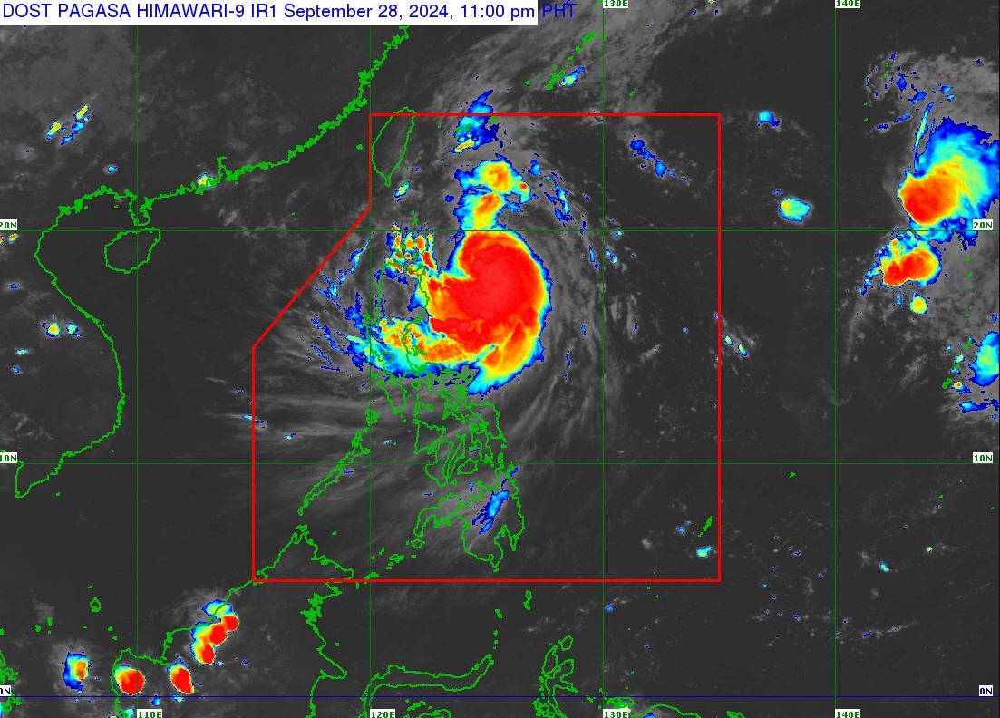
Tropical Storm Julian picked up some strength as it slowly moved over the Philippine Sea east of Cagayan, PAGASA said in its 11 p.m. Saturday bulletin.
At 10 p.m., Julian was spotted 345 kilometers east of Aparri, Cagayan, carrying maximum sustained winds of 85 km/h and gustiness of up to 105 km/h.
It was traveling southwestward at 10 km/h.
Signal No. 1 was raised over the following areas:
- Batanes
- Cagayan including Babuyan Islands
- Isabela
- Apayao
- Abra
- Kalinga
- the eastern and central portions of Mountain Province (Natonin, Paracelis, Sadanga, Barlig, Bontoc)
- the eastern portion of Ifugao (Aguinaldo, Alfonso Lista, Mayoyao)
- Ilocos Norte
- the northern portion of Ilocos Sur (Sinait, Cabugao, San Juan, Magsingal, Santo Domingo, Bantay, San Ildefonso, San Vicente)
- the northern portion of Aurora (Dilasag, Casiguran)
Heavy rainfall is expected in the following areas in the next three days:
Saturday night to Sunday evening
- Heavy to intense: Babuyan Islands
- Moderate to heavy: Batanes, mainland Cagayan, and Ilocos Norte
Sunday evening to Monday evening
- Heavy to intense: Batanes, Cagayan, and Ilocos Norte
- Moderate to heavy: Apayao, Abra, Ilocos Sur, La Union, and Benguet
Monday evening to Tuesday evening
- Intense to torrential: Batanes and Babuyan Islands
- Heavy to intense: Mainland Cagayan, Apayao, Abra, and Ilocos Norte
- Moderate to heavy: the rest of Ilocos Region and Cordillera Administrative Region
''Under these conditions, flooding and rain-induced landslides are possible, especially in areas that are highly or very highly susceptible to these hazards as identified in hazard maps and in areas with significant antecedent rainfall,'' PAGASA said.
Julian may also bring strong to gale-force gusts over the following areas (especially in coastal and upland areas exposed to winds):
Sunday: Aurora, CALABARZON, Romblon, and Bicol Region
Monday: Aurora, Pangasinan, Zambales, Bataan, Metro Manila, CALABARZON, Romblon, and Bicol Region.
Julian could move generally west northwestward to northwestward from Saturday evening through Tuesday morning towards the Batanes-Babuyan Islands area, before accelerating over the waters east of Taiwan for the rest of Tuesday onwards.
''A landfall or close approach scenario on Monday (September 30) through Tuesday early morning over Batanes and/or Babuyan Islands is highly likely,'' PAGASA said.
''Julian will continue to intensify throughout the forecast period and reach typhoon category by tomorrow evening. There is high chance of rapid intensification, and the possibility of reaching super typhoon category is not ruled out. This tropical cyclone will be closest to Batanes and/or Babuyan Islands at or near peak intensity.'' —VBL, GMA Integrated News
