

Signal No. 1 up over Babuyan Islands, Cagayan towns due to Julian
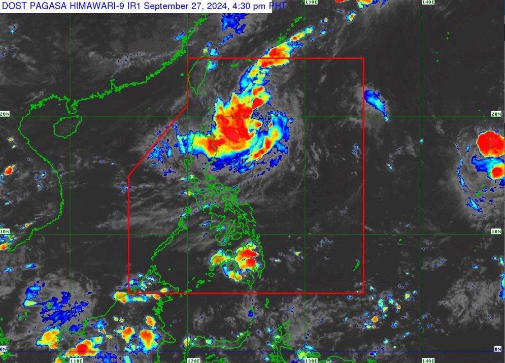
State weather bureau PAGASA raised Signal No. 1 over parts of Cagayan on Friday as Tropical Depression Julian maintained its strength while traversing the Philippine Sea.
Placed under Tropical Cyclone Wind Signal No. 1 were the Babuyan Islands and the eastern portion of mainland Cagayan (Santa Ana, Gonzaga, Gattaran, Lal-Lo, Baggao, Buguey, Aparri, Santa Teresita, Camalaniugan, Peñablanca, Ballesteros).
Heavy rainfall outlook was issued for the following areas:
Friday to Saturday afternoon
- Moderate to Heavy (50 to 100 mm): Cagayan
Saturday afternoon to Sunday afternoon
- Moderate to Heavy (50 to 100 mm): Cagayan, Isabela, Batanes, Apayao, and Ilocos Norte
Sunday afternoon to Monday afternoon
- Moderate to Heavy (50 to 100 mm): Isabela, and the rest of Ilocos Region and Cordillera Administrative Region
- Heavy to Intense (100 to 200 mm): Cagayan, Batanes, Apayao, and Ilocos Norte
The following areas may experience strong to gale-force gusts:
Saturday: Aurora and the northern portion of Quezon
Sunday: Aurora, CALABARZON, Romblon, Marinduque, Bicol Region, Aklan, and the northern portion of Antique
At 4 p.m., Julian was located 445 kilometers east southeast of Itbayat, Batanes, or 425 km east of Basco, Batanes, with maximum sustained winds of 55 km/h near the center and gustiness of up to 70 km/h.
It was moving southwestward at 20 km/h.
Before becoming a typhoon on Sunday, Julian is expected to develop into a tropical storm between Friday night and Saturday morning.
''Rapid intensification is increasingly likely,'' PAGASA said.
PAGASA is not ruling out the possibility of raising Signal No. 3 or 4 while Julian is inside the Philippine Area of Responsibility (PAR).
''Julian is forecast to follow a looping path over the waters east of Batanes and Cagayan in the next five days. Initially, the tropical cyclone will head south southwestward or southwestward today through early Sunday (September 29) while decelerating, then move slowly northwestward or north northwestward beginning mid-Sunday, then turn northward or north northeastward on Tuesday (October 1) onwards,'' it said.
''There is an increasing chance that the track forecast will shift westward in the succeeding bulletins, bringing the projected path of Julian closer to Extreme Northern Luzon.''
In the next 24 hours, Julian will bring cloudy skies with scattered rains and thunderstorms over Ilocos Norte, Ilocos Sur, Abra, Apayao, Kalinga, Mt. Province, Batanes, Cagayan, and Isabela, while the rest of the country will experience partly cloudy to cloudy skies with isolated rain showers or thunderstorms due to localized thunderstorms.
Flash floods or landslides may occur as a result of these weather conditions.
Moderate to strong winds with moderate to rough waters may be observed over Northern Luzon, while the rest of the country will feel light to moderate winds with slight to moderate coastal waters.
Sunrise in Metro Manila will be at 5:45 a.m. on Saturday. —Vince Angelo Ferreras and Jiselle Anne Casucian/VBL, GMA Integrated News
