

LPA develops into Tropical Depression Julian, to bring rains over parts of Luzon
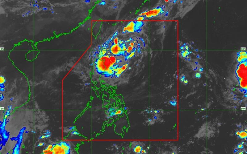
The low pressure area (LPA) east of Batanes has developed into a tropical depression and has been named "Julian," and is expected to bring cloudy skies with scattered rain over parts of Luzon on Friday, PAGASA said in its early morning bulletin.
As of 3 a.m., Julian was estimated based at 535 kilometers east of Itbayat, Batanes with maximum sustained winds of 55 kilometers per hour near the center, gustiness of up to 70 kph and moving south southwestward at 15 kph.
Meanwhile, PAGASA is also monitoring another tropical depression outside the Philippine area of responsibility (PAR). As of 3 a.m., it is estimated at 2,600 kilometers east of Central Luzon and packing maximum sustained winds of 55 kph, gustiness of up to 70 kph, and moving north northwestward at the speed of 15 kph.
Ilocos Norte, Apayao, Batanes, Cagayan including Babuyan Islands, and Isabela will experience cloudy skies with scattered rains and thunderstorms due to Julian with the possibility that flash floods or landslides will occur due to moderate to at times heavy rains.
Metro Manila and the rest of the country will have partly cloudy to cloudy skies with isolated rain showers or thunderstorms due to localized thunderstorms with the possibility that flash floods or landslides will occur during severe thunderstorms.
No Tropical Cyclone Wind Signal (TCWS) is currently hoisted, but TCWS No. 1 may be hoisted over portions of Cagayan Valley within the day, PAGASA said.
Hazards affecting coastal waters
Moderate seas expected over Batanes, Cagayan, and Isabela reaching up to 2.5 meters, according to PAGASA's bulletin.
"Mariners of motorbancas and similarly-sized vessels are advised to take precautionary measures while venturing out to sea and, if possible, avoid navigation under these conditions," the weather bureau warned.
Track and Intensity Outlook
"Julian is forecast to follow a looping path over the waters east of Batanes and Cagayan in the next five days. Initially, the tropical cyclone will head south southwestward today while decelerating, then move slowly westward on Saturday (28 September) and northwestward on Sunday (29 September), before accelerating generally northward on Monday (30 September) and Tuesday (01 August)," said PAGASA.
The tropical depression will continuously intensify and will be at severe tropical storm and typhoon categories by Sunday and Tuesday, respectively.
Wind speed forecast
The wind speed forecast for Luzon is light to moderate moving in the northwest to southwest direction with slight to moderate coastal waters.
Visayas and Mindanao will experience light to moderate wind speed moving in the west to southwest direction with slight to moderate coastal waters.
Sunrise will be at 5:45 a.m., sunset at 5:48 p.m. — BAP, GMA Integrated News
