

PAGASA: LPA inside PAR may turn into a storm
State weather bureau PAGASA said Sunday that the low pressure area (LPA) that entered the Philippine Area of Responsibility (PAR) on Sunday has a low chance of becoming a storm within the next 24 to 48 hours.
“Ngunit patuloy pa rin natin ito minomonitor dahil medyo may kalapitan sa ating kalupaan,” PAGASA weather specialist Ana Clauren told Super Radyo DzBB.
(But we continue to monitor the LPA because it is relatively close to our landmass.)
“Kahit LPA pa lang ito, possible magdulot ng kalat-kalat na ulan lalo na sa may Cagayan Valley area at Isabela,” she added.
(Even though it is just an LPA, it is possible that it may cause scattered rains, especially in the Cagayan Valley area and Isabela.)
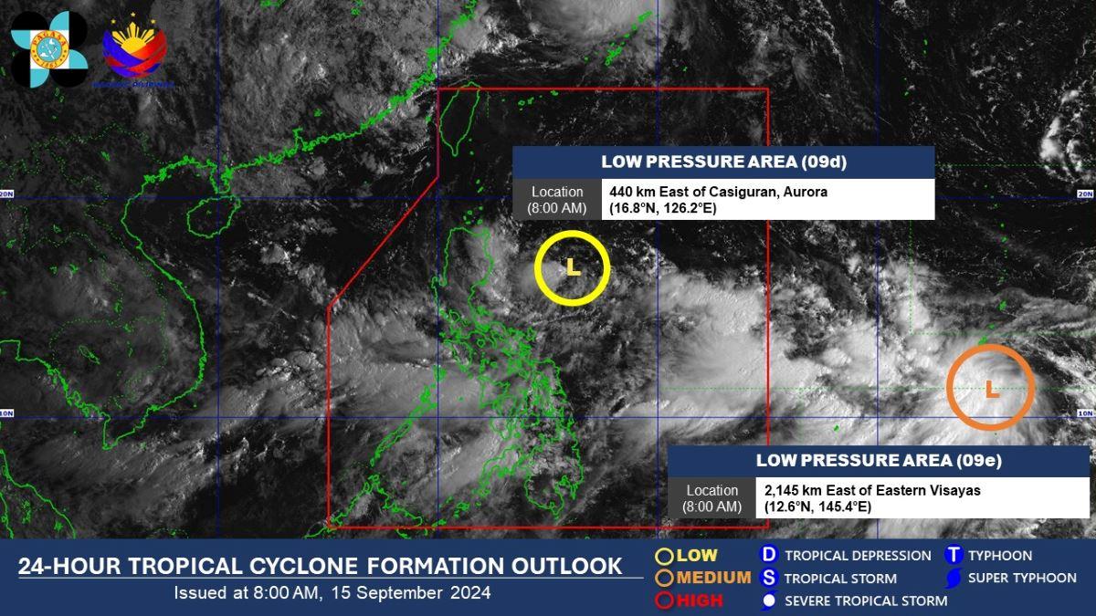
The LPA was last located at 8 a.m. on Sunday at 440 kilometers (km) east of Casiguran, Aurora.
Meanwhile, Clauren said PAGASA is also monitoring another LPA outside PAR.
Last spotted 2,145 km east of Eastern Visayas, the second LPA has a higher chance of becoming a storm in the next 24 to 48 hours, Clauren said.
However, the LPA outside PAR has no direct impact on the country’s weather conditions since it is far from the landmass.
Clauren said the two LPAs may enhance the Southwest Monsoon (Habagat) in the next few days.
In its forecast issued Sunday morning, PAGASA said Habagat is affecting Southern Luzon, Visayas and Mindanao and will bring rains over several areas. —Mariel Celine Serquiña/KG, GMA Integrated News
