

PAGASA: Heavy rains seen as Ferdie to enhance Southwest Monsoon
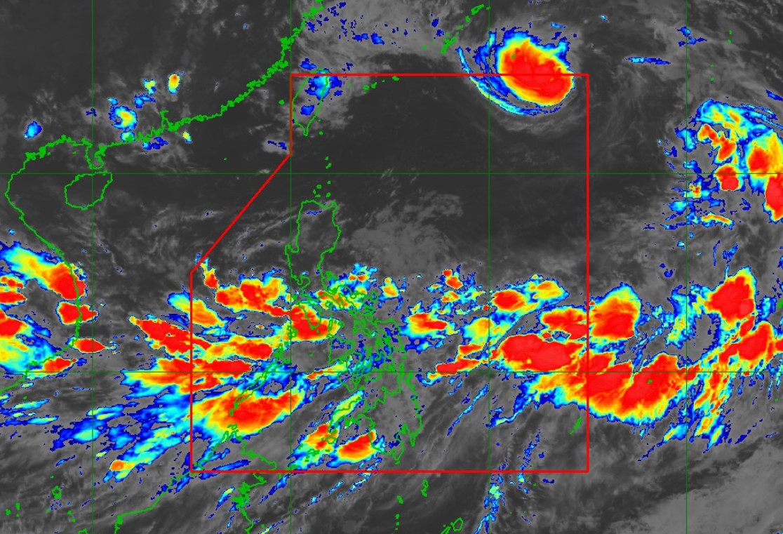
Tropical Storm Ferdie is expected to continue enhancing the Southwest Monsoon as it passes through the Philippine Area of Responsibility.
According to PAGASA’s 11 p.m. cyclone bulletin on Friday, Ferdie was last seen moving northwestward at 35 kph at 1,285 km East Northeast of Extreme Northern Luzon.
Ferdie had maximum sustained winds of 85kph and gustiness of up to 105 kph.
PAGASA’s weather advisory on Friday night indicated rainfall due to the Southwest Monsoon over the following areas over the weekend:
Friday night to Saturday evening
- Heavy to Intense rains (100 to 200 mm): MIMAROPA, the southern portion of Quezon, Western Visayas, and Negros lsland Region
- Moderate to Heavy rains (50 to 100 mm): Zambales, Bataan, Metro Manila, the rest of CALABARZON, Bicol Region, the rest of Visayas, Misamis Occidental, Zamboanga del Norte, Lanao del Norte, Lanao del Sur, Maguindanao del Norte, Maguindanao del Sur, Sultan Kudarat, Sarangani, Basilan, Sulu, and Tawi-Tawi
Saturday evening to Sunday evening
- Heavy to Intense rains (100 to 200 mm): Occidental Mindoro, the northern portion of Palawan, Aklan, and Antique
- Moderate to Heavy rains (50 to 100 mm): The southern portion of Quezon, Bicol Region, the rest of MIMAROPA, Negros Island Region, and the rest of Western Visayas
Sunday evening to Monday evening
- Heavy to Intense rains (100 to 200 mm): Occidental Mindoro and the northern portion of Palawan
- Moderate to Heavy rains (50 to 100 mm): The rest of MIMAROPA, Camarines Sur, Catanduanes, Albay, Sorsogon, Masbate, Negros Occidental, and Western Visayas
PAGASA warned that flooding and lanslides are likely to occur over the following areas and advised concerned offices to remain vigilant.
The tropical storm and the enhanced Southwest Monsoon is predicted to bring strong to gale-force gusts over the following areas on the following dates:
- Friday night to Saturday evening: Batangas, MIMAROPA, Bicol Region, Visayas, Caraga, Northern Mindanao, Zamboanga Peninsula, BARMM, and Davao Region
- Saturday evening to Sunday evening: Batangas, MIMAROPA, Bicol Region, Visayas, Caraga Region, Northern Mindanao, Zamboanga Peninsula, BARMM, and Davao Region
- Sunday evening to Monday evening: MIMAROPA, Bicol Region, Visayas, Caraga, Northern Mindanao, Zamboanga Peninsula, and Davao Region
Moderate to rough seas are also expected over the following areas:
- 1.5 to 3.5 m: The seaboards of Palawan, the western seaboard of Western Visayas, the western seaboard of Negros Island Region, the southern seaboard of Negros Island Region, the southern seaboard of Central Visayas, the southern seaboard of Eastern Visayas, the seaboard of Caraga Region, the seaboard of Northern Mindanao, the northern and western seaboards of Zamboanga Peninsula, and the eastern seaboard of Davao Region.
- 1.0 to 3.0 m: The eastern seaboard of Eastern Visayas
- 1.0 to 2.5 m: The northern seaboard of Ilocos Region, the northern seaboard of Cagayan Valley, the southern seaboard of Quezon, the seaboards of Bicol Region, and the remaining seaboards of MIMAROPA, Visayas, Davao Region, and Zamboanga Peninsula
The remaining seaboards of the country will experience up to moderate seas within the next 24 hours.
Ferdie is predicted to remain a tropical storm, with the possibility of re-intensifying into a severe tropical storm by Saturday and developing into a typhoon as it approaches the Eastern China Sea.
The storm will remain far from the Philippine landmass and exit the PAR by Saturday morning. —NB, GMA Integrated News
