

Trough of Bebinca, Habagat affect PH
Cloudy skies and rains will prevail across the country because of the trough of Severe Tropical Storm Bebinca and the Southwest Monsoon (Habagat), the state weather bureau PAGASA said Thursday afternoon.
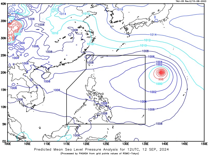
According to PAGASA’s daily weather forecast, Bebinca had maximum sustained winds of 100 km/h and gustiness of up to 125 km/h and was moving northward at 35 km/h as of 3 p.m.
It was located 1,885 kilometers east of Northern Luzon.
Bebinca was forecast to enter the Philippine Area of Responsibility on Friday afternoon or evening and exit the PAR region between Friday late evening and Saturday morning.
''Throughout the forecast period, Bebinca will remain far from the Philippine landmass,'' PAGASA said.
In the next 24 hours, the trough of the tropical cyclone may cause cloudy skies with scattered rains and thunderstorms over Ilocos Region, Cordillera Administrative Region, Cagayan Valley, Quezon, and Aurora, and partly cloudy to cloudy skies with isolated rain showers or thunderstorms over Metro Manila and the rest of Luzon.
Monsoon rains are expected in Palawan, Occidental Mindoro, Western Visayas, Negros Island Region, BARMM, Zamboanga Peninsula, and SOCCKSARGEN.
The Habagat may bring cloudy skies with scattered rains and thunderstorms over the Bicol Region and the rest of MIMAROPA, Visayas, and Mindanao.
Flash floods or landslides may occur as a result of these weather conditions.
Moderate to strong winds with moderate to rough coastal waters may be expected in the eastern section of Mindanao, while light to moderate winds with slight to moderate coastal waters may be observed elsewhere in the Philippines.
Sunrise in Metro Manila will be at 5:45 a.m. on Friday. — Jiselle Anne Casucian/VBL, GMA Integrated News
