

Enteng located over the Cordilleras, 11 areas remain under Signal No. 2
Enteng located over the Cordilleras with 11 areas under Storm Signal No. 2 while enhanced southwest monsoon or habagat to bring moderate to intense rainfall in other areas of Luzon, PAGASA reported in the latest Tropical Cyclone Bulletin.
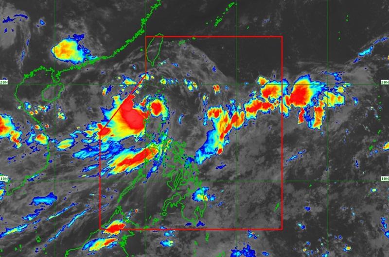
The center of Tropical Storm Enteng was estimated to be in the vicinity of Kabugao, Apayao packing maximum sustained winds of 75 km/h near the center, gustiness of up to 125 km/h, and central pressure of 994 hPa.
Enteng continues to move northwestward at 20 km/h with strong to gale-force winds extend outwards up to 190 km from the center.
Tropical Cyclone Wind Signal (TCWS) No. 2 is hoisted over the following areas:
Luzon
- Ilocos Norte
- the northern portion of Ilocos Sur (Sinait, Cabugao, San Juan, Magsingal, Santo Domingo, San Ildefonso, San Vicente, Santa Catalina, City of Vigan, Bantay, Santa, Caoayan)
- Apayao
- Abra
- Kalinga
- Mountain Province
- Ifugao
- Cagayan including Babuyan Islands
- the northern and central portions of Isabela (Santo Tomas, Alicia, San Mateo, Aurora, Santa Maria, Quezon, San Mariano, Ramon, Naguilian, Roxas, San Guillermo, Luna, Delfin Albano, City of Cauayan, Echague, San Pablo, Ilagan City, Angadanan, Benito Soliven, City of Santiago, Tumauini, Cabagan, Reina Mercedes, San Manuel, Cabatuan, Quirino, Divilacan, Gamu, San Isidro, Mallig, Cordon, Jones, Maconacon, Burgos, San Agustin)
- the northern portion of Quirino (Cabarroguis, Diffun, Saguday, Aglipay)
- the northern portion of Nueva Vizcaya (Diadi, Bagabag)
TCWS No. 1 is hoisted over the following areas:
Luzon
- Batanes
- the rest of Ilocos Sur
- La Union
- Benguet
- the rest of Isabela
- the rest of Nueva Vizcaya
- the rest of Quirino
- the northeastern portion of Nueva Ecija (Carranglan, Pantabangan, Bongabon)
- the northern and central portions of Aurora (Casiguran, Dilasag, Dinalungan)
Heavy Rainfall Outlook
Forecast accumulated rainfall: Today (3 September)
• 100-200 mm: Ilocos Region, Apayao, Abra, Benguet
• 50-100 mm: Cagayan Valley, and the rest of Cordillera Administrative Region.
PAGASA reported that forecast rainfall are generally higher in elevated or mountainous areas.
"Under these conditions, flooding and rain-induced landslides are expected especially in areas that are highly or very highly susceptible to these hazards as identified in official hazard maps and in localities that experienced considerable amounts of rainfall for the past several days," said PAGASA.
Severe Winds
Local winds may be slightly stronger/enhanced in coastal and upland/mountainous areas exposed to winds. Winds are less strong in areas sheltered from the prevailing wind direction.
Minor to moderate impacts from strong winds are possible within any of the localities where Wind Signal No. 2 is hoisted while there would be minimal to minor impacts from strong winds are possible within any of the areas under Wind Signal No. 1.
Enhanced Southwest Monsoon
The enhanced southwest monsoon or habagat will bring moderate to intense rainfall in other areas of Luzon over the next three days and will also bring strong to gale-force gusts over the following areas (especially in coastal and upland areas exposed to winds): Ilocos Region, Nueva Vizcaya, Quirino, Zambales, Bataan, Aurora, Bulacan, Metro Manila, CALABARZON, MIMAROPA, Bicol Region, Western Visayas, Negros Island Region, and Northern Samar.
There will also be minimal to moderate risk of storm surge may occur in the next 48 hours in the low-lying or exposed coastal localities of Batanes, Cagayan, Isabela, Ilocos Norte, Ilocos Sur, and northern Aurora.
The weather bureau also reported that Enteng and the enhanced southwest monsoon will bring the following conditions over the coastal waters of the country:
- Gale Warning is in effect over the seaboards of Northern Luzon and the eastern seaboards of Central and Southern Luzon. Sea travel is risky for small seacrafts, including all types of motorbancas. For more information, refer to Gale Warning No. 4 (intermediate) issued at 11:00 PM yesterday.
- Moderate to rough seas over the western seaboard of Northern and Central Luzon (1.5 to 3.0 m), the western seaboard of Southern Luzon, the eastern and southern seaboards of Southern Luzon outside Gale Warning areas, and the western seaboard of Visayas (1.5 to 2.5 m). Mariners of small seacrafts, including all types of motorbancas, are advised not to venture out to sea under these conditions, especially if inexperienced or operating ill-equipped vessels.
- Slight to moderate seas are expected over the eastern seaboards of Visayas and Mindanao (1.0 to 2.0 m). Mariners of motorbancas and similarly-sized vessels are advised to take precautionary measures while venturing out to sea and, if possible, avoid navigation under these conditions.
Track and Intensity Outlook
Enteng is forecast to continue moving northwestward and emerge over the northwestern portion of Ilocos Region by Tuesday morning then move generally westward over the West Philippine Sea from Wednesday to Thursday. The tropical cyclone may exit the Philippine Area of Responsibility by Wednesday morning.
Enteng is forecast to maintain tropical storm category during its traverse of mainland Northern Luzon and and further intensify to become a severe tropical storm by Tuesday afternoon or evening, and typhoon category by Thursday. — BAP, GMA Integrated News
