

Enteng now in Quirino after landfall in Aurora
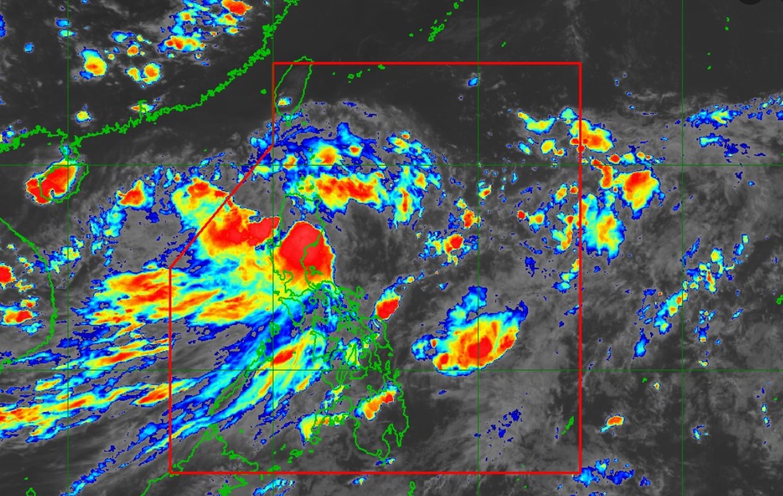
Tropical Storm Enteng on late Monday afternoon moved over Quirino after making landfall in Casiguran, Aurora, the weather bureau PAGASA has said.
According to its 5 p.m. tropical cyclone bulletin, Enteng was spotted in the viciity of Maddela town with maximum sustained winds of 85 kph near the center and gustiness of up to 140 kph.
Signal No. 2 has been raised over the following areas:
- Ilocos Norte,
- Apayao,
- the eastern portion of Kalinga (Rizal, Pinukpuk, City of Tabuk),
- Cagayan including Babuyan Islands,
- Isabela,
- Quirino, and
- the northern portion of Aurora (Casiguran, Dilasag, Dinalungan, Dipaculao, Baler)
Signal No. 1 is hoisted over:
- Batanes,
- Ilocos Sur,
- La Union,
- the eastern portion of Pangasinan (Rosales, Asingan, Binalonan, Sison, San Manuel, Santa Maria, Balungao, San Quintin, Tayug, Umingan, Natividad, San Nicolas),
- Abra,
- the rest of Kalinga,
- Mountain Province,
- Ifugao,
- Benguet,
- Nueva Vizcaya,
- the rest of Aurora,
- Nueva Ecija,
- the eastern portion of Bulacan (Doña Remedios Trinidad, Norzagaray, City of San Jose del Monte, Obando, City of Meycauayan, Bocaue, Balagtas, Bustos, Baliuag, Pandi, Santa Maria, Marilao, Angat, San Rafael, San Ildefonso, San Miguel),
- Metro Manila,
- Rizal,
- the northeastern portion of Laguna (Santa Maria, Mabitac, Pakil, Pangil, Famy, Siniloan), and
- the northern portion of Quezon (General Nakar, Infanta, Real) including Polillo Islands
The tropical cyclone is seen to continue heading north northwestward or northward over Cagayan Valley or northern Cordillera Administrative Region before turning west northwestward over the Babuyan Channel by Tuesday.
“Enteng is forecast to maintain tropical storm category during its traverse of mainland Northern Luzon. Further intensification is forecast to occur from [Tuesday] late evening onwards,” PAGASA said.
Enteng may intensify into a severe tropical storm by Tuesday late evening or Wednesday morning and become a typhoon by Thursday.
PAGASA said the enhanced Southwest Monsoon (Habagat) will bring moderate to intense rainfall in other areas of Luzon and Visayas (especially along the western portions) over the next three days.
On Tuesday, the Habagat will bring strong to gale-force gusts over the Ilocos Region, Nueva Vizcaya, Quirino, Zambales, Bataan, Aurora, Bulacan, Metro Manila, Calabarzon, Mimaropa, Bicol Region, Western Visayas, Negros Island Region, Northern Samar.
“A minimal to moderate risk of storm surge may occur in the next 48 hours in the low-lying or exposed coastal localities of Batanes, Cagayan, Isabela, Ilocos Norte, Ilocos Sur, and Aurora,” PAGASA said.
A gale warning was issued over the northern and eastern seaboards of Luzon. Small vessels were advised to refrain from sailing amid the bad weather.
The state weather bureau also said coastal conditions in several parts of the country would be moderate to rough.
—NB, GMA Integrated News
